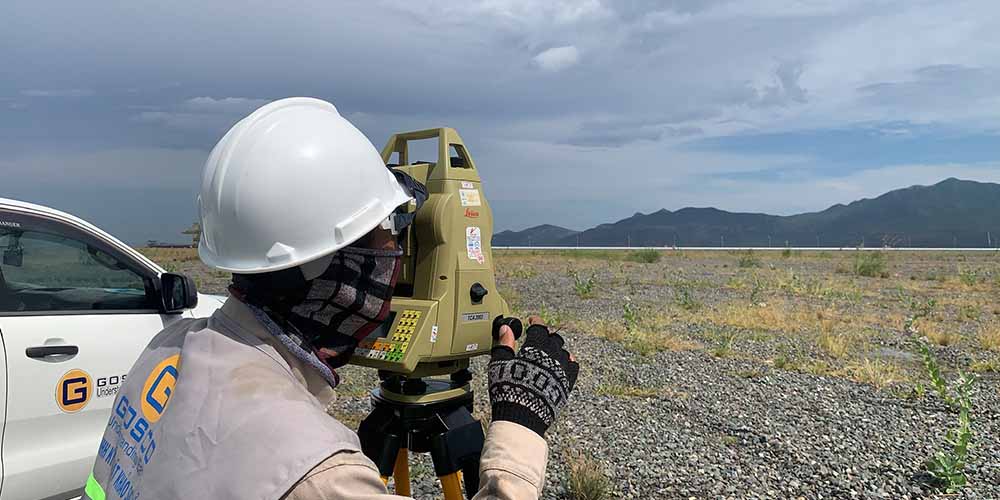
We have skilled and experienced surveying engineers, we provide survey services
Construction surveys aim to gather real-world information about land conditions, structures, and related environmental factors to support project design, implementation, or planning.
Ensure design and construction align with actual conditions.
Minimize risks arising during project execution.
Optimize costs and implementation time.

About GOSCO
Golden Sea Surveying Technology Co., Ltd (GOSCO), established in 2017, is a private company specializing in onshore and offshore surveying, data processing, and site investigation reporting. Our expertise includes topographic, geological, engineering geology, hydro-meteorological surveys, and flood studies.
With a team of experienced, English-proficient engineers, many of whom have held key positions in leading consultancy firms and worked in countries like Laos, Pakistan, and Thailand, we have extensive experience in power projects. These include wind, solar, hydropower, thermal power, transmission lines, and substations.
What We Do
Our mission
Providing to Clients outstanding quality services, in accordance with existing Viet Nam and International codes and standards, timely satisfying required schedule.
Efficiently cooperation with reliable Partners, increasing profit to Clients, which is also for GOSCO as well as social welfare.
Our Vision
To become a strong brand in the field of site survey, especially in the Central, High Land, Southern and Coastal Region of Vietnam.
Our Core Values
Professional: We always try to learn, cultivate professional knowledge, ready to face difficulties and challenges to meet the increasing requirements of Client
Creativity: With every difficult task faced, we always consider as a blessing and an opportunity to improve the Company's capability with advanced and effective solutions of our engineers in the company.
Honesty: We understand that honesty is the ticket to success, and the valuable asset of people and company. Therefore, we always adhere to ethical and to be honest in every word and action.
GOSCO - CONSTRUCTION SURVEY SERVICES
We specialize in providing comprehensive surveying services in the following fields:
With over 20 years of experience, we have been involved in numerous large-scale projects in renewable energy, infrastructure construction, and various other fields.
We serve a diverse range of clients, including construction companies, government organizations, and individuals seeking professional survey services. Our operations extend beyond Vietnam to Southeast Asia and international markets.

GOSCO - Topographical survey
Topographical surveying is a crucial component in construction, planning, and infrastructure development projects. The main activities include:
Topographic surveying and mapping
"Topographic surveying and mapping" in geodesy is the process of measuring and mapping to represent the shape and characteristics of the terrain and features on the ground or underwater in a specific area. A topographic map includes information about elevations, terrain (contour lines), and structures or objects on or beneath the surface.

Scope of work
Topographic Maps on Land: Surveying the terrain of construction areas, urban zones, hills, and plains. Depicting elevation, contour lines, and physical features (e.g., vegetation, structures, roads).
Underwater Topographic Maps:
Combined Mapping: Surveying and mapping areas that intersect between land and water, such as riverbanks, dikes, or reservoirs.
Objectives
Analysis and Design:
Monitoring and Management:
Transportation and Irrigation:
Hydrological and Maritime Management:
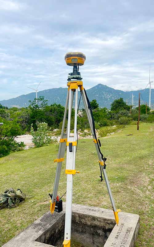
Equipment:
Topographic Maps on Land:
Topographic Maps Underwater:
Includes Single Beam Echo Sounder (SBES) or Multibeam Echo Sounder (MBES).
Processing Software:
Contact
We always listen to all comments from customers. If you have any problems or questions about the service, please contact us:
(+84) 98 226 5526
survey@gosco.vn
Contact formSection measurement
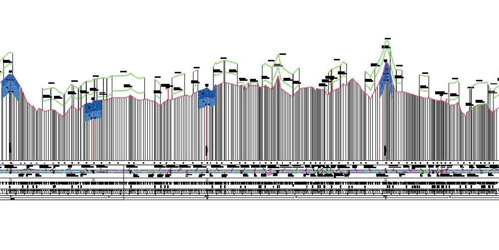
Cross-section surveying in geodesy is the process of measuring, collecting data, and creating drawings to represent the cross-sectional views (both transverse and longitudinal) of terrain, structures, or specific objects. These cross-sections depict variations in elevation or terrain characteristics along a specific route or axis.
Scope of work
Construction: Surveying for the design of roads, residential, and industrial structures.
Irrigation and Hydropower: Surveying to support the design of dams, reservoirs, and irrigation systems.
Mining: Cross-section mapping of open-pit mines or underground mines.
Power Transmission Lines: Cross-section surveying along transmission line routes for 35kV, 110kV, 220kV, and 500kV systems.
Geology and Environment: Study terrain structures, assess landslide risks, and analyze flood hazards.
Urban Planning: Analyze topography for urban planning and infrastructure design.
Objectives
Analysis and Design:
Monitoring and Inspection:
Resource and Environmental Management:
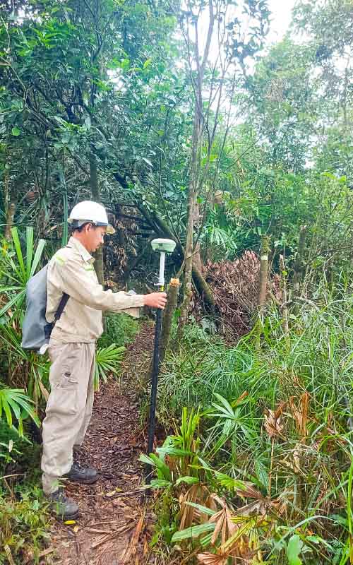
Equipment:
Processing Software:

Contact
We always listen to all comments from customers. If you have any problems or questions about the service, please contact us:
(+84) 98 226 5526
survey@gosco.vn
Contact formDeformation monitoring
Deformation monitoring is the process of measuring and tracking changes in the shape, position, or characteristics of a structure over time due to natural and human-induced factors. Common types of deformation include:
- Settlement Deformation: Monitoring changes in elevation (subsidence) of the structure.
- Lateral Deformation: Tracking horizontal displacement of the structure.
- Inclination Deformation: Observing deviations from the vertical alignment of the structure.
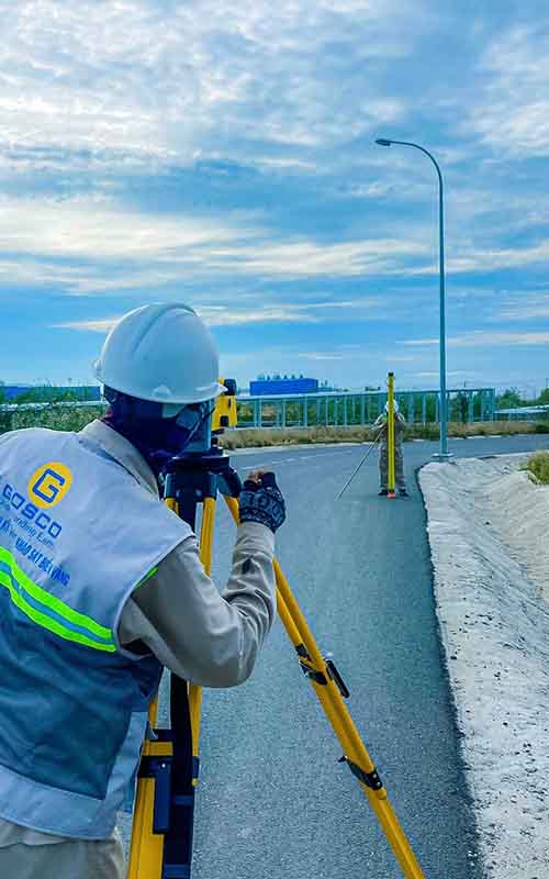
Objectives:
Ensuring Safety:
- Early detection of instability signs to prevent failures such as collapse, tilting, or subsidence that could damage the structure.
Assessing Structural Quality:
- Evaluating the stability and durability of the structure after construction or during its operation.
Supporting Renovation Design:
- Providing data for designing reinforcement and renovation solutions.
Research and Forecasting:
- Studying the impact of loads, geology, and environmental conditions on the structure.
- Predicting deformation trends to develop response plans.
Applicable Fields:
- Construction Projects:
- High-rise buildings, bridges, dams, tunnels, underground structures, thermal power plants.
- Monitoring foundation settlement, column inclination, chimney displacement, or horizontal movement.
- Hydraulic and Hydropower Structures:
- Monitoring dams and reservoirs for leakage or deformation.
- Observing dam bodies, slopes, and water conduits.
- Transportation Infrastructure:
- Monitoring deformation of bridges, roads, railway beds, and highways.
- Industrial Facilities:
- Observing storage tanks, blast furnaces, and cooling towers to assess stability.
- Structures in Special Geological Environments:
- Monitoring in mining areas, underground tunnels, or regions prone to landslides and earthquakes.
Required Equipment:
- Settlement Deformation Measurement:
- Digital Level: Measures elevation differences with high accuracy.
- Total Station: Measures elevations and coordinates of points on the structure.
- Automatic Settlement Sensors: Fixed-mounted devices for continuous monitoring, commonly used in automated monitoring systems.
- Lateral Deformation Measurement:
- Total Station: Measures precise coordinates (X, Y, Z) to track displacement.
- GPS/GNSS RTK System: Provides high-precision positioning, commonly used for large structures or wide areas.
- Automatic Monitoring System: Includes sensors and signal receivers for real-time horizontal displacement tracking.
- Inclination Deformation Measurement:
- Inclinometer: Records the tilt of columns, walls, or structures along specific axes.
- Total Station: Tracks inclination angles by measuring coordinate changes at observation points.
- Automatic Tilt Sensors: Fixed-installed devices for continuous monitoring of angular changes.
Contact
We always listen to all comments from customers. If you have any problems or questions about the service, please contact us:
(+84) 98 226 5526
survey@gosco.vn
Contact form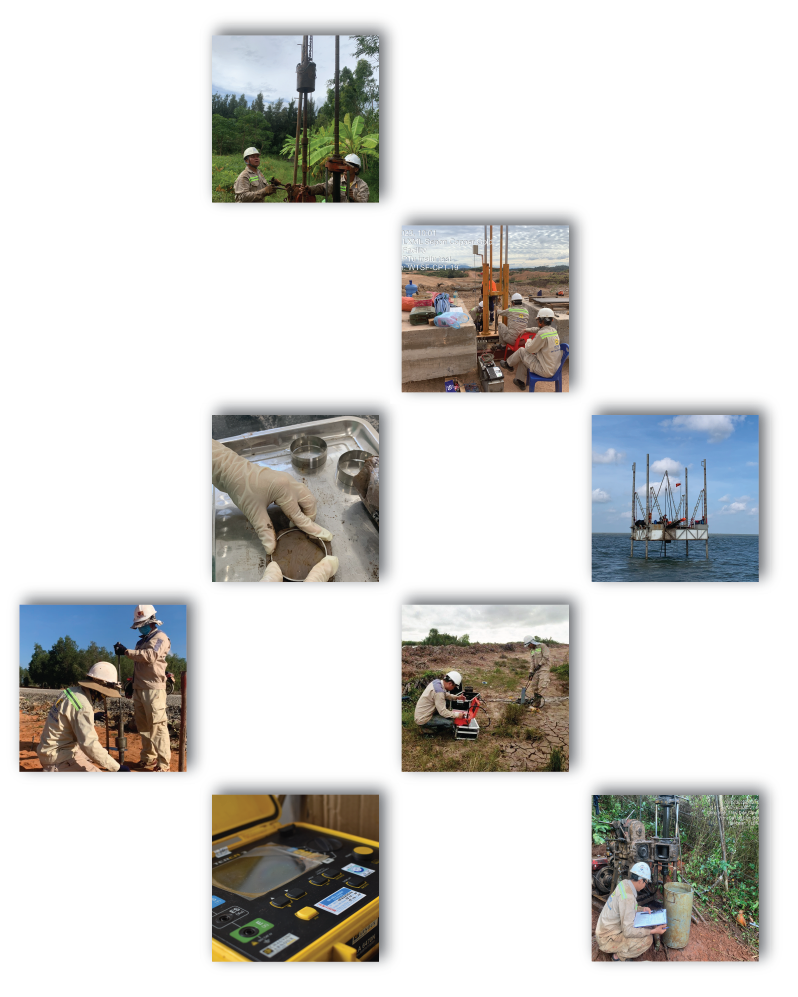
GOSCO - Geological survey
Geological surveying is a critical process for understanding the composition, structure, and properties of the Earth's subsurface. It plays a vital role in construction and risk management. Key activities include:
Geotechnical Drilling Survey
General Introduction:
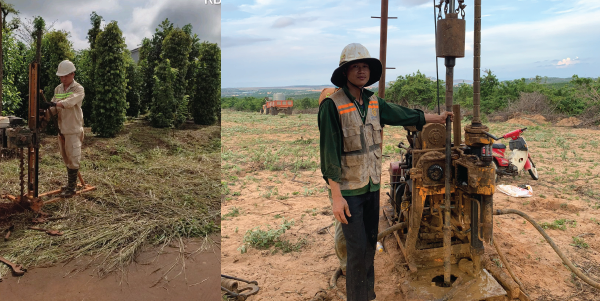
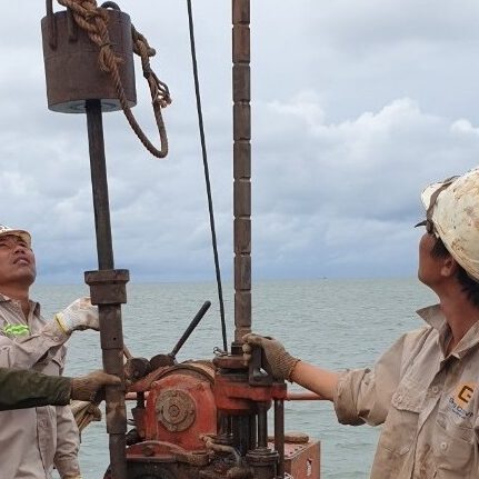
Drilling is a part of geotechnical surveying, which involves using drilling machines with different types of drill bits and rods to penetrate the ground to a certain depth (which can reach hundreds of meters).
During the drilling process, core samples are collected to describe the subsurface stratigraphy. Various types of samples, such as undisturbed samples, disturbed samples, water samples, and rock samples, are taken and analyzed in laboratories to determine the physical and mechanical properties of the soil, the chemical composition of groundwater, and the corrosive potential of water on standard concrete.
Purpose of Geotechnical Drilling Survey:
Geotechnical Drilling Survey:
Drilling Survey:
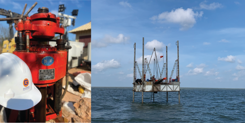
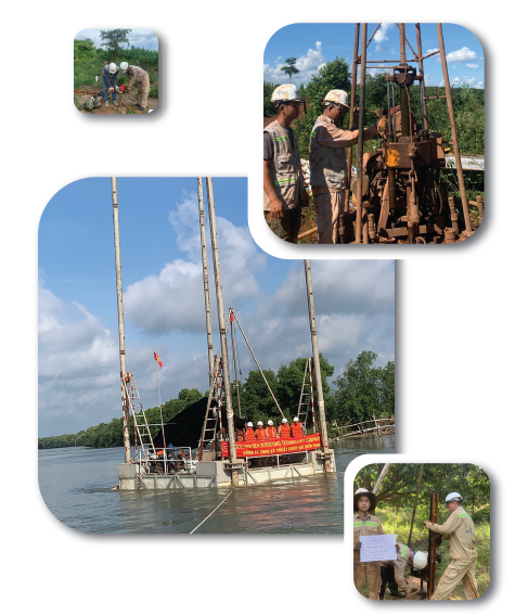
- Offshore Drilling: Geotechnical drilling for offshore construction projects poses a significant challenge for engineers and surveyors, especially when conducted under adverse weather conditions such as high waves, strong winds, or storms. Drilling at sea is particularly difficult when using floating platforms like buoys, boats, or barges, as these are inherently unstable and highly affected by wind, waves, ocean currents, and tides, making deep drilling operations more challenging.
- Onshore Drilling: Onshore drilling includes both machine drilling and manual drilling, depending on the type of project and specific technical requirements.
Core Sampling Drilling: involves the use of specialized drilling pipes to collect high-quality samples. Drilling work can be carried out under various conditions, such as on land, in plains, swamps, mountainous areas, or even underwater. Depending on the geological conditions and construction objectives, the drilling process and depth of the borehole will vary. The samples collected may include soil samples, rock samples, or water samples.
Field tests: are conducted in the borehole, including tests like Standard Penetration Tests (SPT), water pouring tests in the borehole, water pressure tests in the borehole, water suction tests in the borehole, and wave velocity measurements of the foundation (downhole tests, crosshole tests), to assess the soil’s properties in situ.
Geotechnical Drilling Equipment:
- Jack-up Drilling Rig:: GOSCO is equipped with jack-up rigs for underwater drilling, especially for offshore projects. Jack-up rigs have high mobility and are less affected by weather conditions such as wind, waves, ocean currents, or tides. This stability ensures that the drilling process maintains quality and meets the critical project timelines.
- Drilling Machines: GOSCO utilizes various drilling machines, including XY-1a drilling machine, XY-3 drilling machine, and manual drilling machines UKB25/45 for different survey and drilling needs.
Contact
We always listen to all comments from customers. If you have any problems or questions about the service, please contact us:
(+84) 98 226 5526
survey@gosco.vn
Contact form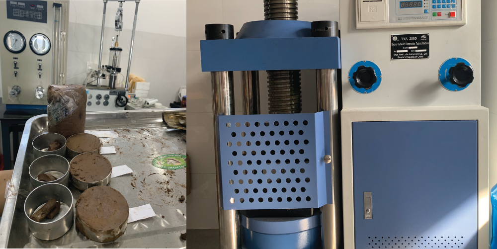
LABORATORY TEST: LAS-XD410
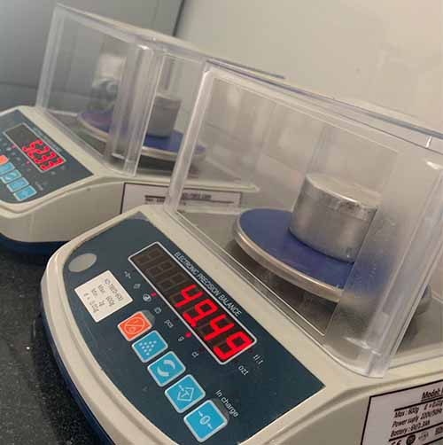
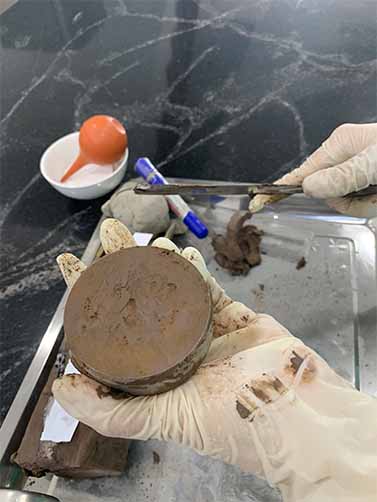
Laboratory soil sample testing is a crucial step in geotechnical investigation. The results provide essential information about the physical and mechanical properties of soil, rock, and water, serving as the foundation for construction design and execution. Below are the common types of samples tested in the laboratory and the corresponding tests.
Soil sample:
Rock sample:
Rock samples are taken from subsurface soil and rock layers to evaluate the mechanical properties and strength of the rock:
- Unconfined Compression Test: Measures the compressive strength of the rock sample.
- Brazilian Test: Evaluates the tensile strength of the rock.
Corrosive Water Samples:
Corrosive water samples are collected from soil or construction sites to determine the potential for material corrosion:
- Chloride and Sulfate Ion Analysis: Determines concentrations of ions that cause corrosion in metals and concrete.
- Total Dissolved Solids (TDS) Test: Evaluates the mineralization level of water.
17 physical-mechanical properties of a soil sample
- Soil particle composition.
- Soil moisture content.
- Bulk density (specific weight) of the soil.
- Specific gravity of the soil.
- Dry density of the soil.
- Buoyant density of the soil.
- Void ratio of the soil.
- Soil porosity.
- Soil saturation.
- Liquid limit of the soil.
- Plastic limit of the soil.
- Plasticity index.
- Consistency.
- Internal friction angle of the soil.
- Cohesion of the soil.
- Soil compressibility coefficient.
- Soil modulus of deformation.
Contact
We always listen to all comments from customers. If you have any problems or questions about the service, please contact us:
(+84) 98 226 5526
survey@gosco.vn
Contact formGeological survey
Geological field test - In situ test
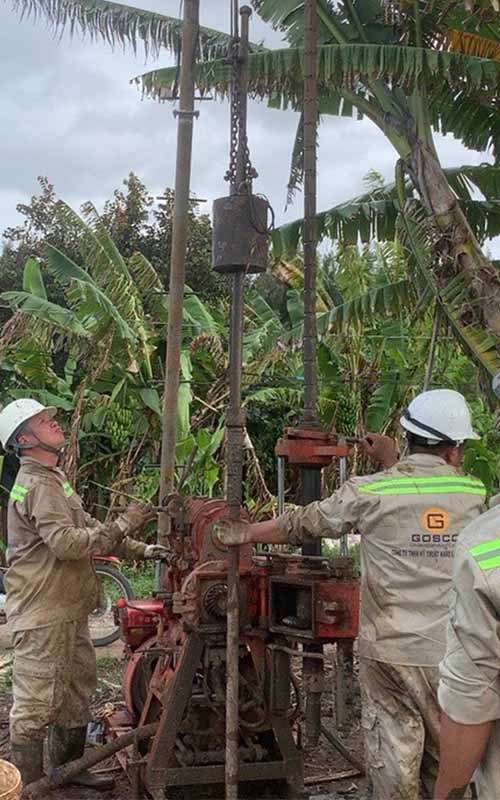
Standard penetration test (SPT)
Standard Penetration Test (SPT)
Standard Penetration Test (SPT) is a testing method in the field of geotechnical engineering used to determine the physical and mechanical properties of soil at the site. This is one of the common testing methods to evaluate the bearing capacity of the ground and test the engineering geology.
Standard code:
Scope of work:
Geotechnical Investigations: Widely used in construction projects (housing, bridges, roads, dams) to assess the physical and mechanical properties of the soil.
Assessment of Soil Compaction and Bearing Capacity:
Foundation Design:Provides input parameters for shallow foundation, pile foundation design, and stability analysis of the soil.
Soil Classification:Supports the classification of soil based on geotechnical criteria.
Contact
We always listen to all comments from customers.
If you have any problems or questions about the service, please contact us:
(+84) 98 226 5526
survey@gosco.vn
Contact form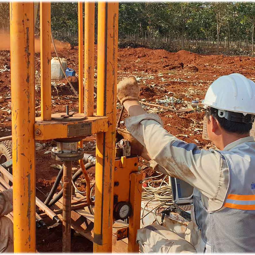
Cone penetration test (CPTu)
Cone penetration test (CPTu)
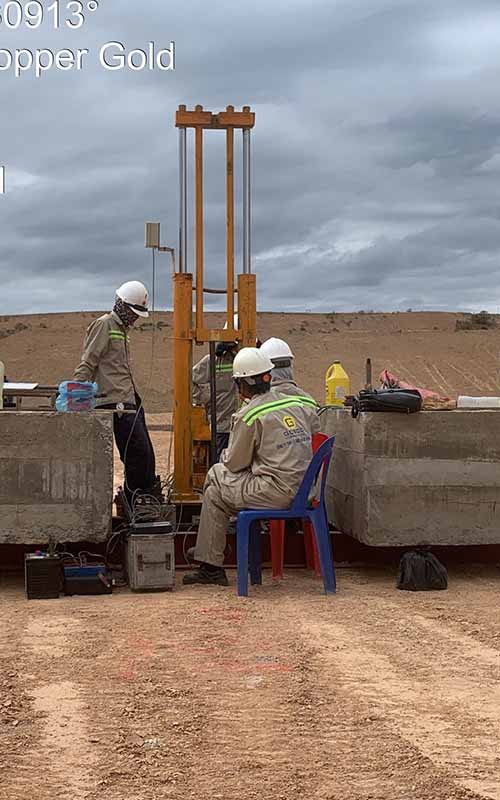
CPTu Test (Cone Penetration Test with pore pressure measurement) is a field test method used to evaluate the physical and mechanical properties of soil. It is a modern and widely used technique in geotechnical engineering for investigating subsurface conditions.
Standard code:
Objectives of CPTu Testing:
Determining in-situ soil mechanical properties: CPTu testing provides data on cone tip resistance (Qc), sleeve friction (Fs), and pore water pressure (u2), allowing the assessment of mechanical properties such as strength, compressibility, and permeability of soil layers.
Soil classification: CPTu helps differentiate soil types such as clay, sand, gravel, or transitional soils based on soil behavior type (SBT) charts.
Foundation stability analysis: It provides essential information for calculating foundation stability, settlement, and soil dynamic properties required for construction design.
Pore water pressure evaluation: It evaluates the drainage conditions of soils and identifies liquefaction potential in loose soils.
Scope of Application of CPTu Testing:
Advantages of CPTu Testing:
Limitations and Constraints:
Contact
We always listen to all comments from customers.
If you have any problems or questions about the service, please contact us:
(+84) 98 226 5526
survey@gosco.vn
Contact form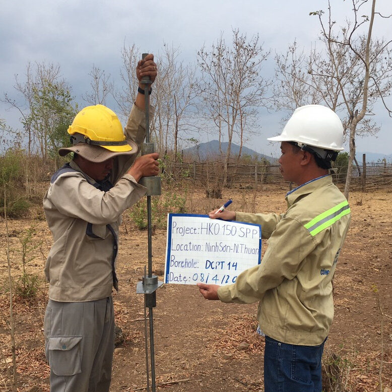
Dynamic cone penetration test (DCPT)
Dynamic Cone Penetration Test (DCPT)
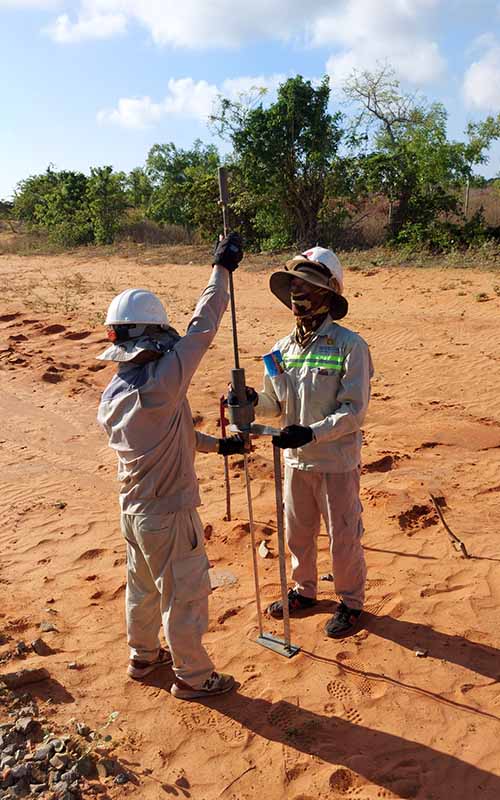
The Dynamic Cone Penetration Test (DCPT) is a geotechnical field testing method in which a standard cone tip is driven into the soil using energy from a free-falling hammer. This test is used to determine soil compaction and other geotechnical properties of the ground.
A standard cone is mounted on the penetration rod. A hammer falls freely from a certain height, exerting energy on the cone, penetrating it into the ground. The number of times the hammer falls to penetrate a certain depth (usually 10 cm) is recorded.
Standard code:
Scope of Application:
Primary Applications:Contact
We always listen to all comments from customers.
If you have any problems or questions about the service, please contact us:
(+84) 98 226 5526
survey@gosco.vn
Contact form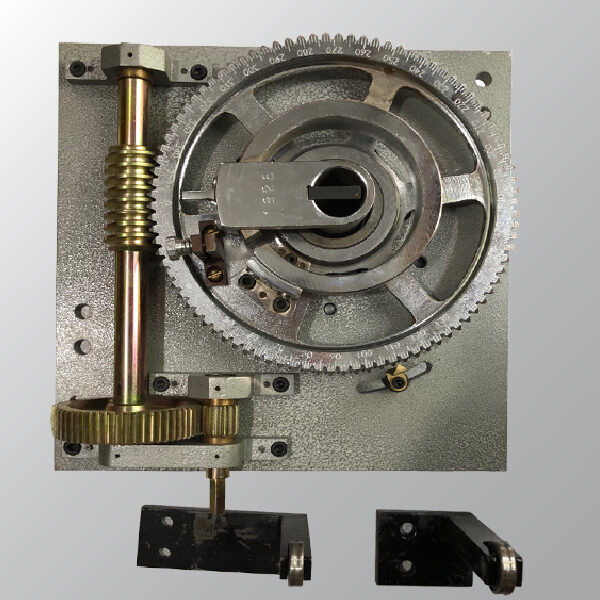
Field Vane Test
Field Vane Shear Test(FVS)
The Field Vane Shear Test (FVS) is an in situ method used to directly measure the undrained shear strength of cohesive soils. In this test, a cross-shaped vane is inserted into the soil at the test location and rotated slowly at a constant rate to measure the force required to shear the soil around the vane. This method is widely employed to evaluate the mechanical properties of weak soils, such as soft clay or mud.

Standard code:
Scope of Application:
Primary Applications:Contact
We always listen to all comments from customers.
If you have any problems or questions about the service, please contact us:
(+84) 98 226 5526
survey@gosco.vn
Contact form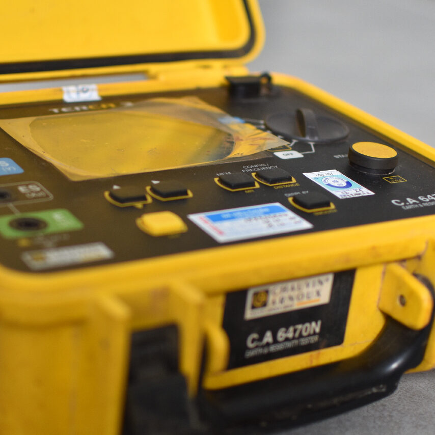
Earth Resistivity test
Earth Resistivity test
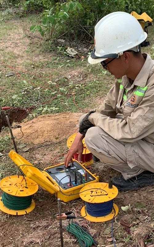
Earth Resistivity test or Soil Resistivity test is an important method in geological, geotechnical and environmental surveys. This method helps determine the electrical conductivity of soil, thereby assessing soil properties such as moisture, chemical composition and geological structure. One of the popular methods for measuring soil resistivity is the Wenner method.
Standard code:
Scope of work:
Application:
Advantages:
Disadvantages:
Wenner Method:
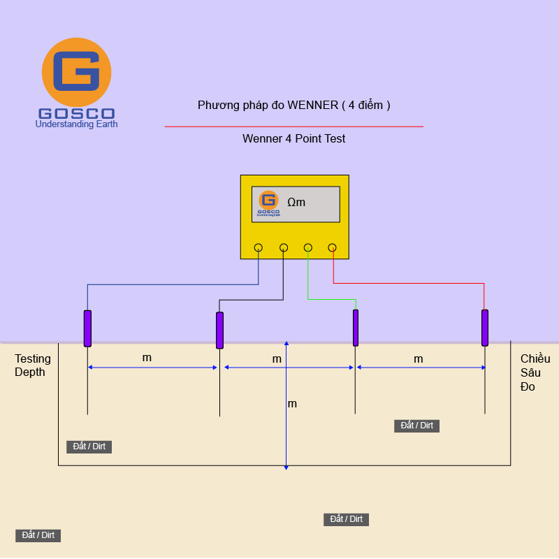
The Wenner method, developed by Frank Wenner, uses the principle of resistivity measurement by arranging four electrodes in a straight line with equal spacing on the ground surface. The two outer electrodes (A and B) are used to inject current, while the two inner electrodes (M and N) measure the voltage.
The formula for resistivity calculation is:
ρ=2πaR
where:
Contact
We always listen to all comments from customers.
If you have any problems or questions about the service, please contact us:
(+84) 98 226 5526
survey@gosco.vn
Contact form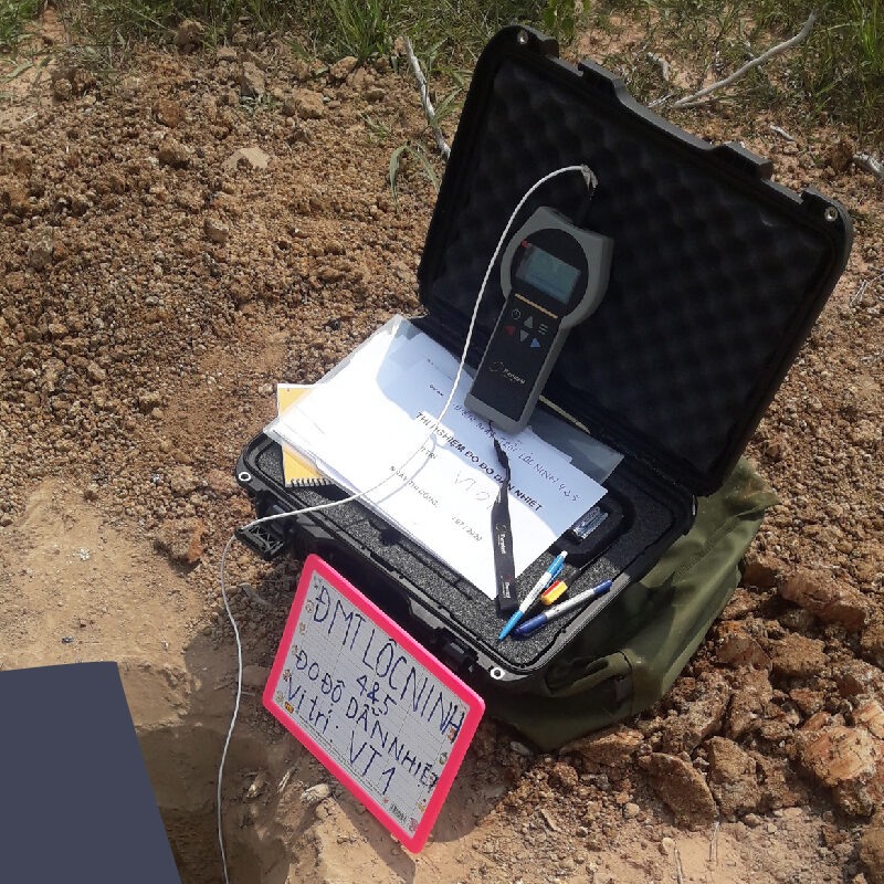
Thermal resistivity test
Thermal Resistivity Testing of Soil
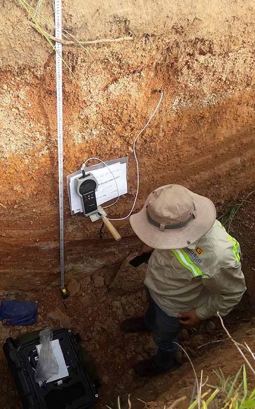
Thermal resistivity of soil is a parameter that characterizes the soil's resistance to heat transfer. It is defined as the reciprocal of thermal conductivity and is typically expressed in units of °C·m/W or K·m/W.
The test often utilizes equipment such as thermal resistivity meters or hot-wire method devices.
Standard code:
Scope of work:
This test is applied in the following fields:
Purpose
Contact
We always listen to all comments from customers.
If you have any problems or questions about the service, please contact us:
(+84) 98 226 5526
survey@gosco.vn
Contact form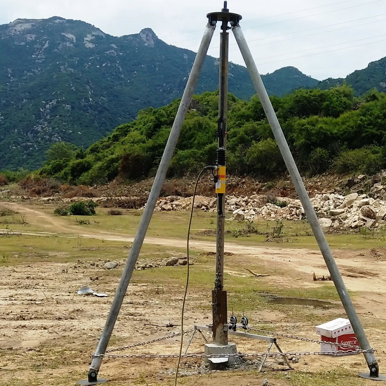
Pull out test
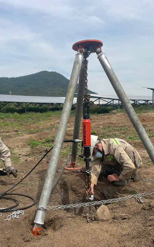
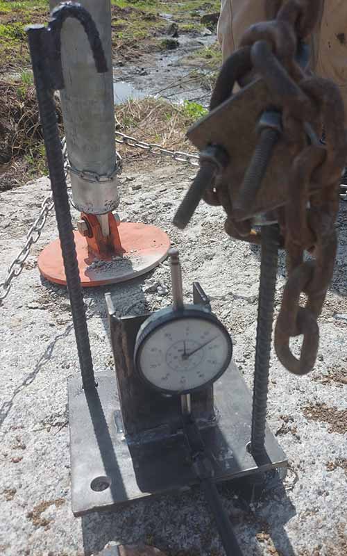
Pile Testing: Pull-Out, Lateral Loading, and Compression Tests
Pull-out, lateral load, and compression tests are essential for assessing load-bearing capacities and ensuring project safety. Choosing the right test and adhering to standards is crucial.
Standard code:
Pull-Out Test:
Testing Scope
Purpose
Lateral Load Test:
Testing Scope
Purpose
Compression Test:
Testing Scope
Purpose
Contact
We always listen to all comments from customers.
If you have any problems or questions about the service, please contact us:
(+84) 98 226 5526
survey@gosco.vn
Contact form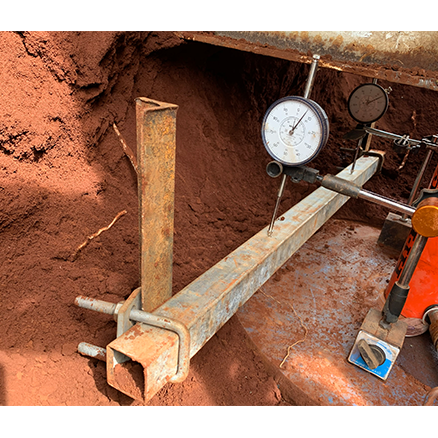
Static load test
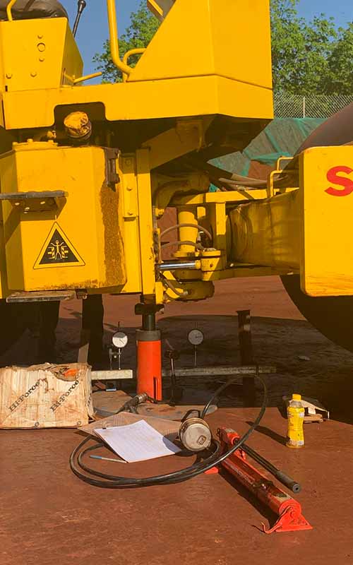
Plate Load Test
The plate load test is an in-situ method used to determine the bearing capacity and modulus of subgrade elasticity of the soil. It involves applying a compressive load to a steel plate of fixed diameter or size placed on the soil surface and measuring the soil settlement.
The plate load test is a crucial method for evaluating the bearing capacity and elastic properties of the subgrade. Proper execution according to standards ensures quality and safety for construction projects.
Standard code:
Scope of Work:
Purpose
Advantages:
Disadvantages:
Contact
We always listen to all comments from customers.
If you have any problems or questions about the service, please contact us:
(+84) 98 226 5526
survey@gosco.vn
Contact form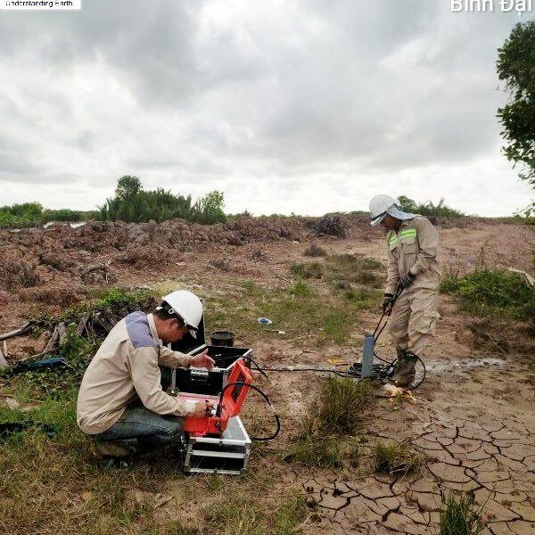
Wave velocity test
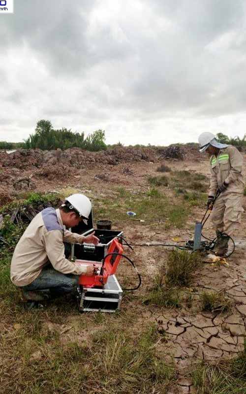
Wave Velocity Test
The Wave Velocity Test is a geophysical method used to determine the mechanical properties of soil and rock by measuring the velocity of wave propagation through the medium. Common wave types include compressional waves (P-wave) and shear waves (S-wave).
Standard code:
Scope of Work:
Non-destructive method that does not alter the geotechnical environment.
Provides detailed information about the mechanical properties of the soil.
Suitable for complex ground conditions such as rock or deep soil layers.
Contact
We always listen to all comments from customers.
If you have any problems or questions about the service, please contact us:
(+84) 98 226 5526
survey@gosco.vn
Contact form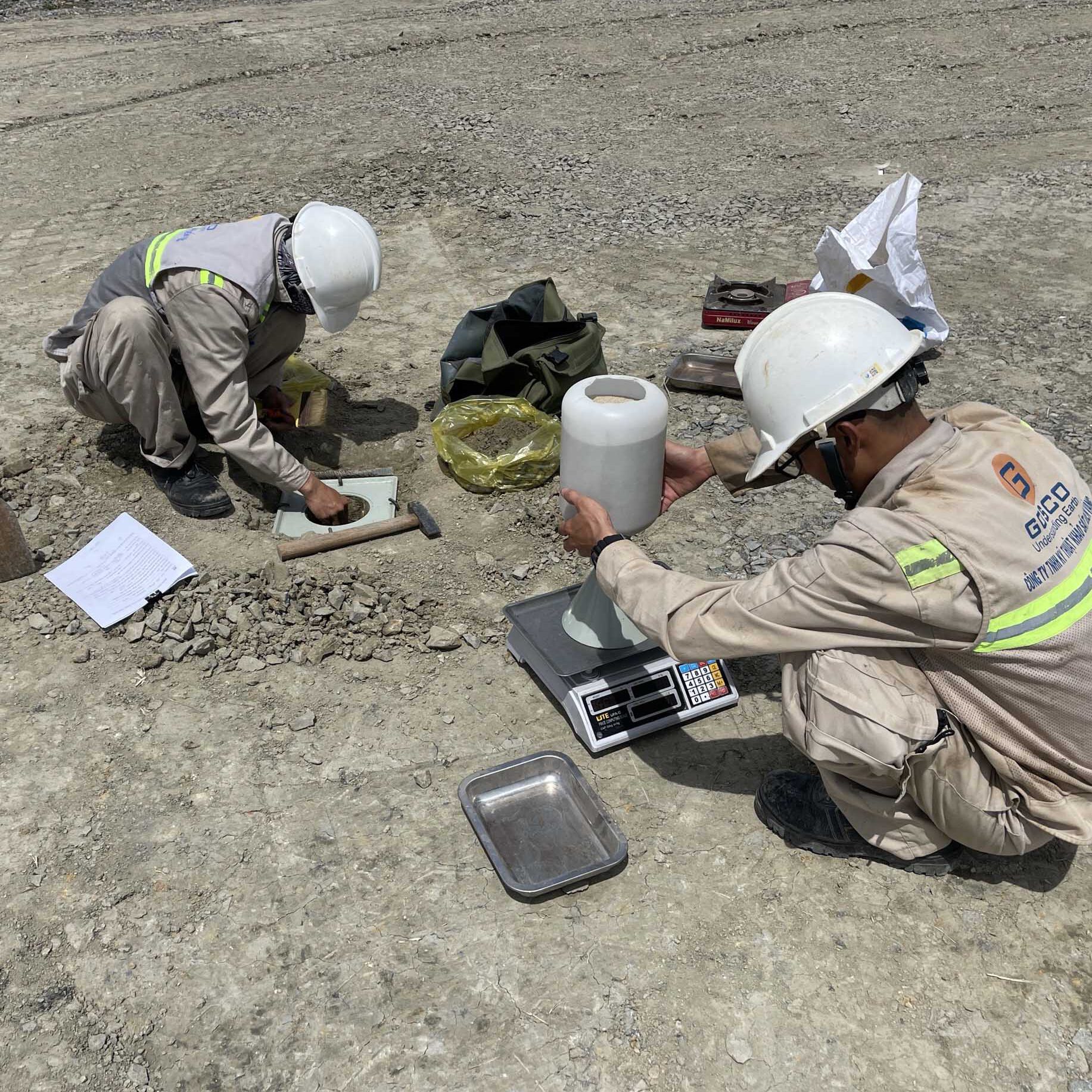
Sand Cone Test
Sand Cone Test
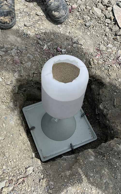
Sand Cone Test is a field testing method used to determine the dry density of soil. It is commonly applied to evaluate the compaction of soil after it has been compacted.
The Sand Cone Test is an effective and reliable method for evaluating soil compaction in the field.
Standard code:
Scope of Work:
Contact
We always listen to all comments from customers.
If you have any problems or questions about the service, please contact us:
(+84) 98 226 5526
survey@gosco.vn
Contact form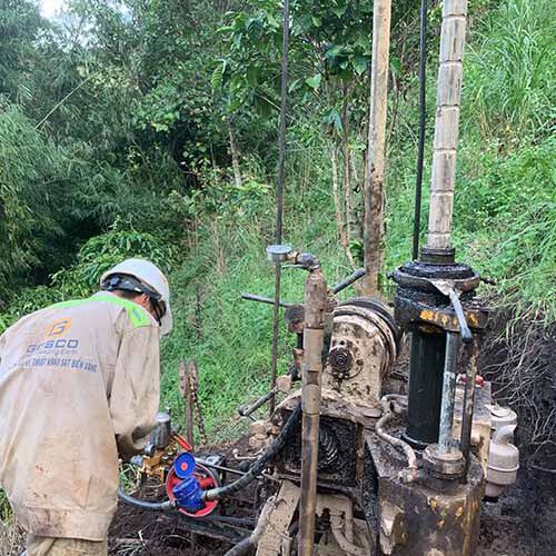
Hydrogeological test
Hydrogeological test: Water Injection Test, Water Filling Test, Water Extraction Test
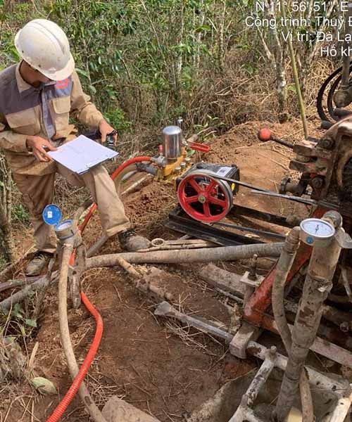
These are field tests conducted in boreholes to evaluate the permeability, water retention, and response of geological formations to water injection, flow, or extraction. These tests provide critical data for hydrogeological studies, engineering design, and groundwater assessments.
Standard code:
Scope of Work:
Water Injection Test: Inject water under controlled pressure to assess the permeability and response of geological formations.
Water Filling Test: Fill the borehole with water to evaluate water retention and infiltration behavior.
Water Extraction Test: Pump water out to determine aquifer properties and the influence of groundwater withdrawal.
Contact
We always listen to all comments from customers.
If you have any problems or questions about the service, please contact us:
(+84) 98 226 5526
survey@gosco.vn
Contact form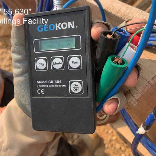
Piezometer installation
Piezometer Test
The Piezometer test is a method to measure pore water pressure in soil or geological layers to assess stress conditions, permeability, and stability of geotechnical structures. Piezometers are typically installed in boreholes or structures to collect hydraulic data.
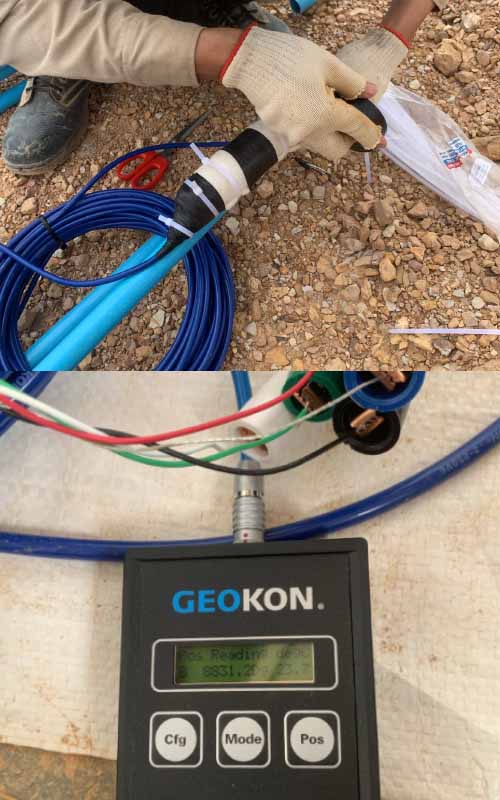
Standard code:
Scope of Work:
Contact
We always listen to all comments from customers.
If you have any problems or questions about the service, please contact us:
(+84) 98 226 5526
survey@gosco.vn
Contact form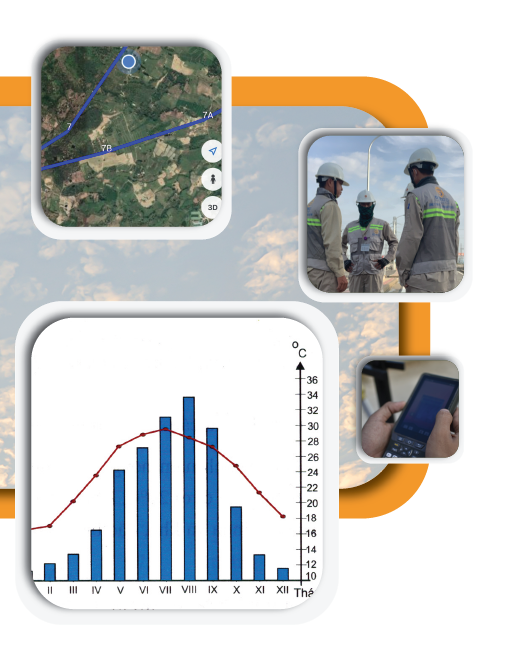
Hydrometeorology Survey
Meteorological and hydrological survey is the process of collecting, measuring, and analyzing data related to climatic factors (such as temperature, humidity, and wind) and hydrological elements (such as water levels, flow rates, and currents) to support research, forecasting, or resource and environmental management planning.
Data collection and evaluate the main features of the climate:
- Climate zone
- Total rainfall
- Humidity of the air
- Temperature
- Storm activity
Projects
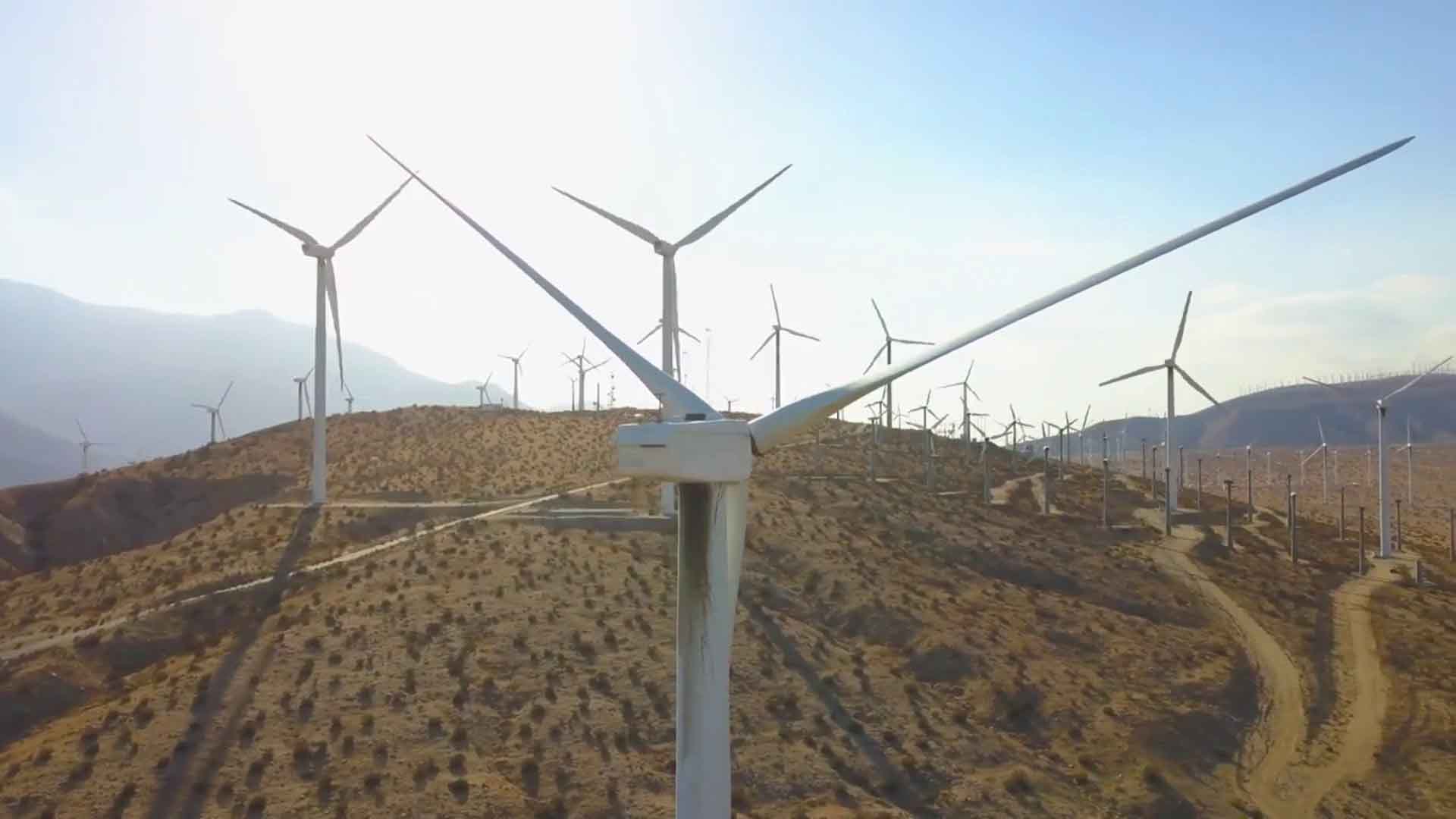
Wind Power Plant
GOSCO has surveyed more than 30 Wind power projects across the country. We are committed to providing professional, accurate and efficient services, contributing significantly to the success of renewable energy projects.
Projects: Wind Power Plant
|
TT/ No. |
Nội dung/Content |
Thông tin dự án |
Project information |
|
1 |
Công trình/Project |
Nhà máy điện mặt trời Gio Thành 1 |
Gio Thanh 1 solar power plant |
|
Chủ đầu tư/Owner |
Công ty CP năng lượng Gio Thành |
Gio Thanh Energy JSC |
|
|
Giai đoạn/Stage |
NCKT |
Feasibility Study |
|
|
Công suất/Capacity |
50MW |
50MW |
|
|
Thầu chính/M.Contractor |
Công ty TNHH kỹ thuật ứng dụng Việt Nam |
Vietnam Applied Technical Co., Ltd |
|
|
Gói thầu/Package |
Khảo sát địa hình, địa chất và KTTV |
Topographical survey, geological investigation and hydrology survey |
|
|
Năm/Year |
06/2018 |
06/2018 |
|
|
2 |
Công trình/Project |
Nhà máy điện gió Nexif Energy (Bến Tre) |
Nexif Energy Ben Tre windfarm, capacity 30MW |
|
Chủ đầu tư/Owner |
Công ty TNHH một thành viên Nexif Bến Tre |
Nexif Energy Ben Tre One Member Co., Ltd |
|
|
Giai đoạn/Stage |
NCKT |
Feasibility Study |
|
|
Công suất/Capacity |
30MW |
30MW (Phase I) |
|
|
Thầu chính/M.Contractor |
Công ty CP Tư vấn xây dựng Điện 5 |
Power engineering consulting JSC 5 |
|
|
Gói thầu/Package |
Khảo sát địa hình, địa chất và KTTV |
Topographical survey, geological investigation and hydrology survey |
|
|
Năm/Year |
09/2018 |
09/2018 |
|
|
3 |
Công trình/Project |
Nhà máy điện gió số7 Ba Tri, Bến Tre, 30MW |
Windfarm No.7 Ba Tri, Ben Tre, capacity 30MW |
|
Chủ đầu tư/Owner |
Công ty CP Năng lượng tái tạo Bến Tre |
Ben Tre Renewable Energy JSC |
|
|
Giai đoạn/Stage |
FEASIBILITY STUDY |
Feasibility Study |
|
|
Công suất/Capacity |
30MW (Phase I) |
30MW (Phase I) |
|
|
Gói thầu/Package |
Khảo sát địa hình, địa chất |
Topographical survey, geological investigation |
|
|
Năm/Year |
12/2018 |
12/2018 |
|
|
4 |
Công trình/Project |
Trang trại phong điện HBRE Chư Prông |
HBRE Chu Prong wind farm |
|
Chủ đầu tư/Owner |
COMPO Viet Nam JSC |
COMPO Viet Nam JSC |
|
|
Giai đoạn/Stage |
NCKT |
Feasibility Study |
|
|
Công suất/Capacity |
30MWp |
30MW |
|
|
Thầu chính/M.Contractor |
Công ty TNHH kỹ thuật ứng dụng Việt Nam |
Vietnam Applied Technical Co., Ltd |
|
|
Gói thầu/Package |
Khảo sát địa hình, địa chất và KTTV |
Topographical survey, geological investigation and hydrology survey |
|
|
Năm/Year |
01/2019 |
01/2019 |
|
|
5 |
Công trình/Project |
Trang trại phong điện HBRE An Thọ |
HBRE An Tho windfarm |
|
Chủ đầu tư/Owner |
Công ty CP Phong điện HBRE Phú Yên |
HBRE Phu Yen Wind Power JSC |
|
|
Giai đoạn/Stage |
NCKT |
Feasibility Study |
|
|
Thầu chính/M.Contractor |
Công ty TNHH kỹ thuật ứng dụng Việt Nam |
Vietnam Applied Technical Co., Ltd |
|
|
Công suất/Capacity |
30MWp |
30MW |
|
|
Gói thầu/Package |
Khảo sát địa hình, địa chất và KTTV |
Topographical survey, geological investigation and hydrology survey |
|
|
Năm/Year |
02/2019 |
02/2019 |
|
|
6 |
Công trình/Project |
Nhà máy điện gió Hòa Bình 1 |
Hoa Binh 1 windfarm Power Plant |
|
Chủ đầu tư/Owner |
Công ty CP Đầu tư điện gió Hòa Bình 1 |
Hoa Binh 1 Wind Power Investment JSC |
|
|
Giai đoạn/Stage |
NCKT |
Technical Design |
|
|
Công suất/Capacity |
30MWp |
48MW |
|
|
Gói thầu/Package |
Khảo sát địa hình, địa chất |
Topographical survey, geological investigation |
|
|
Năm/Year |
05/2019 |
05/2019 |
|
|
7 |
Công trình/Project |
Nhà máy điện gió V1-3 Bến Tre |
V1-3 Ben Tre windfarm |
|
Chủ đầu tư/Owner |
Công ty CP Năng lượng Bến Tre |
Ben Tre Energy JSC |
|
|
Giai đoạn/Stage |
TKKT |
Technical Design |
|
|
Công suất/Capacity |
30MW |
30MW |
|
|
Gói thầu/Package |
Khảo sát địa hình, địa chất |
Topographical survey, geological investigation |
|
|
Năm/Year |
08/2019 |
08/2019 |
|
|
8 |
Công trình/Project |
Nhà máy điện gió Quảng Trị TNC 1 và 2 |
Quang Tri TNC 1 &2 Wind Farm |
|
Chủ đầu tư/Owner |
NOVASIA ENERGY |
NOVASIA ENERGY |
|
|
Giai đoạn/Stage |
FEASIBILITY STUDY |
FEASIBILITY STUDY |
|
|
Công suất/Capacity |
30 x2 MW |
30 x2 MW |
|
|
Gói thầu/Package |
Khảo sát địa hình, địa chất |
Topographical survey & geological investigation |
|
|
Năm/Year |
10/2019 |
10/2019 |
|
|
9 |
Công trình/Project |
Nhà máy điện gió Phát triển Miền núi |
Mountain Development Wind Power Plant |
|
Chủ đầu tư/Owner |
Công ty CP Kinh Doanh Và Phát Triển Miền Núi Gia Lai |
Gia Lai Mountainous Business and Development JSC |
|
|
Giai đoạn/Stage |
FEASIBILITY STUDY |
FEASIBILITY STUDY |
|
|
Công suất/Capacity |
30 MW |
30 MW |
|
|
Thầu chính/M.Contractor |
Công ty TNHH kỹ thuật ứng dụng Việt Nam |
Vietnam Applied Technical Co., Ltd |
|
|
Gói thầu/Package |
Khảo sát địa hình, địa chất |
Topographical survey & geological investigation |
|
|
Năm/Year |
11/2019 |
11/2019 |
|
|
10 |
Công trình/Project |
Nhà máy điện gió Chế biến Tây Nguyên |
Mountain Development Wind Power Plant |
|
Chủ đầu tư/Owner |
Công ty TNHH Kinh doanh và Chế biến Tây Nguyên |
Central Highland Business and Processing Co., Ltd |
|
|
Giai đoạn/Stage |
NCKT |
FEASIBILITY STUDY |
|
|
Công suất/Capacity |
30 MW |
30 MW |
|
|
Thầu chính/M.Contractor |
Công ty TNHH kỹ thuật ứng dụng Việt Nam |
Vietnam Applied Technical Co., Ltd |
|
|
Gói thầu/Package |
Khảo sát địa hình, địa chất |
Topographical survey & geological investigation |
|
|
Năm/Year |
11/2019 |
11/2019 |
|
|
11 |
Công trình/Project |
Nhà máy điện gió Hanbaram – gđ2 |
Hanbaram Wind Power Plant-stage2 |
|
Chủ đầu tư/Owner |
Công ty CP Năng lượng Hanbaram |
Hanbaram energy JS Company |
|
|
Giai đoạn/Stage |
NCKT |
FEASIBILITY STUDY |
|
|
Công suất/Capacity |
50MW |
50 MW |
|
|
Thầu chính/M.Contractor |
Công ty TNHH kỹ thuật ứng dụng Việt Nam |
Vietnam Applied Technical Co., Ltd |
|
|
Gói thầu/Package |
Khảo sát địa hình, địa chất và KTTV |
Topographical survey, geological investigation and hydrology survey |
|
|
Năm/Year |
01/2020 |
01/2020 |
|
|
12 |
Công trình/Project |
Trang trại phong điện HBRE Hà Tĩnh |
HBRE Wind Farm Power Plant |
|
Chủ đầu tư/Owner |
Công ty CP Phong điện HBRE Hà Tĩnh |
HBRE Ha Tinh Wind Power JSC |
|
|
Giai đoạn/Stage |
NCKT |
FEASIBILITY STUDY |
|
|
Thầu chính/M.Contractor |
Công ty TNHH kỹ thuật ứng dụng Việt Nam |
Vietnam Applied Technical Co., Ltd |
|
|
Công suất/Capacity |
120MW |
120MW |
|
|
Gói thầu/Package |
Khảo sát địa hình, địa chất |
Topographical survey & geological investigation |
|
|
Năm/Year |
02/2020 |
02/2020 |
|
|
13 |
Công trình/Project |
Nhà máy điện gió Hàm Kiệm |
Ham Kiem wind power plant |
|
Chủ đầu tư/Owner |
Tổng công ty xây dựng số 1 – CTCP |
Construction Corporation No.1 – JSC |
|
|
Giai đoạn/Stage |
NCKT |
FEASIBILITY STUDY |
|
|
Công suất/Capacity |
15MW |
15MW |
|
|
Thầu chính/M.Contractor |
Công ty TNHH kỹ thuật ứng dụng Việt Nam |
Vietnam Applied Technical Co., Ltd |
|
|
Gói thầu/Package |
Khảo sát địa hình, địa chất |
Topographical survey & geological investigation |
|
|
Năm/Year |
6/2020 |
6/2020 |
|
|
14 |
Công trình/Project |
Nhà máy điện gió Phú Lạc 2 |
Phu Lac2 wind power plant |
|
Chủ đầu tư/Owner |
Công ty Cổ phần phong điện Thuận Bình |
Thuan Binh wind power JSC |
|
|
Giai đoạn/Stage |
NCKT |
Feasibility Study |
|
|
Thầu chính/M. contractor |
Công ty TNHH kỹ thuật ứng dụng Việt Nam |
Vietnam Applied Technical Co.,Ltd |
|
|
Công suất/Capacity |
102MWp |
102MWp |
|
|
Gói thầu/Package |
Khảo sát địa hình, địa chất |
Topographical survey & geological investigation |
|
|
Năm/Year |
6/2020 |
6/2020 |
|
|
15 |
Công trình/Project |
Nhà máy điện gió Amaccao Quảng Trị 1 |
Amaccao Quang Tri 1 wind power plant |
|
Chủ đầu tư/Owner |
Công ty cổ phần điện gió Khe Sanh |
Khe Sanh wind power JS Company |
|
|
Giai đoạn/Stage |
NCKT |
Feasibility Study |
|
|
Công suất/Capacity |
49.2MW |
49.2MW |
|
|
Gói thầu/Package |
Khảo sát địa hình, địa chất và KTTV |
Topographical survey, geological investigation and hydrology survey |
|
|
Năm/Year |
7/2020 |
7/2020 |
|
|
16 |
Công trình/Project |
Nhà máy điện gió Ia Bòong – Chư Prong |
Ia Bòong-Chu Prong wind power plant |
|
Chủ đầu tư/Owner |
Công ty CP Năng lượng Tái tạo Chư Prông |
Chu Prong Renewable energy JSC |
|
|
Giai đoạn/Stage |
NCKT |
FEASIBILITY STUDY |
|
|
Công suất/Capacity |
50MW |
50MW |
|
|
Gói thầu/Package |
Khảo sát địa hình, địa chất và KTTV |
Topographical survey, geological investigation and hydrology survey |
|
|
Năm/Year |
7/2020 |
7/2020 |
|
|
17 |
Công trình/Project |
Nhà máy điện gió Ia Pech |
Ia Pech wind power plant |
|
Chủ đầu tư/Owner |
Công ty CP đầu tư năng lượng điện xanh Gia Lai |
Gia Lai green energy investment joint stock company |
|
|
Giai đoạn/Stage |
NCKT |
FEASIBILITY STUDY |
|
|
Công suất/Capacity |
50MW |
50MW |
|
|
Gói thầu/Package |
Khảo sát địa hình, địa chất và KTTV |
Topographical survey, geological investigation and hydrology survey |
|
|
Năm/Year |
8/2020 |
8/2020 |
|
|
18 |
Công trình/Project |
Nhà máy điện gió Ia Pech 2 |
Ia Pech 2 wind power plant |
|
Chủ đầu tư/Owner |
Công ty CP đầu tư năng lượng điện xanh Gia Lai |
Gia Lai green energy investment joint stock company |
|
|
Giai đoạn/Stage |
NCKT |
FEASIBILITY STUDY |
|
|
Công suất/Capacity |
50MW |
50MW |
|
|
Gói thầu/Package |
Khảo sát địa hình, địa chất và KTTV |
Topographical survey, geological investigation and hydrology survey |
|
|
Năm/Year |
8/2020 |
8/2020 |
|
|
19 |
Công trình/Project |
Nhà máy điện gió Ia Pết – Đăk Đoa 1 |
Ia Pet-Dak Doa 1 wind power plant |
|
Chủ đầu tư/Owner |
Công ty CP Phong điện Ia Pết-Đăk Đoa số 1 |
Ia Pet-Dak Doa No.1 wind power JSC |
|
|
Giai đoạn/Stage |
TKKT |
Technical design |
|
|
Tổng thầu/EPC |
Powerchina Huadong Engineering Corp Ltd |
Powerchina Huadong Engineering Corp Ltd |
|
|
Công suất/Capacity |
100MWp |
100MWp |
|
|
Gói thầu/Package |
Khảo sát địa hình, địa chất và KTTV |
Topographical survey, geological investigation and hydrology survey |
|
|
Năm/Year |
11/2020 |
11/2020 |
|
|
20 |
Công trình/Project |
Nhà máy điện gió Ia Pết – Đăk Đoa 2 |
Ia Pet-Dak Doa 2 wind power plant |
|
Chủ đầu tư/Owner |
Công ty CP Phong điện Ia Pết-Đăk Đoa số2 |
Ia Pet-Dak Doa No.2 wind power JSC |
|
|
Giai đoạn/Stage |
TKKT |
Technical design |
|
|
Tổng thầu/EPC |
Powerchina Huadong Engineering Corp Ltd |
Powerchina Huadong Engineering Corp Ltd |
|
|
Công suất/Capacity |
100MWp |
100MWp |
|
|
Gói thầu/Package |
Khảo sát địa hình, địa chất và KTTV |
Topographical survey, geological investigation and hydrology survey |
|
|
Năm/Year |
11/2020 |
11/2020 |
|
|
21 |
Công trình/Project |
DZ đấu nối nhà máy điện gió Sóc Trăng V1.2 |
Transmission line of Soc Trang V1.2 wind power plant |
|
Chủ đầu tư/Owner |
Công ty TNHH điện gió Sóc Trăng |
Soc Trang wind power company limited |
|
|
Giai đoạn/Stage |
TKKT |
Technical Design |
|
|
Công suất/Capacity |
110kV,5km |
110kV,5km |
|
|
Gói thầu/Package |
Khảo sát địa hình, địa chất |
Topographical survey, geological investigation |
|
|
Năm/Year |
11/2020 |
11/2020 |
|
|
22 |
Công trình/Project |
Dự án nhà máy điện gió Phước Minh |
Phuoc Minh wind power plant project |
|
Chủ đầu tư/Owner |
Công ty TNHH điện gió Adani Phước Minh |
Adani Phuoc Minh wind power company Ltd |
|
|
Giai đoạn/Stage |
TKKT |
Technical Design |
|
|
Công suất/Capacity |
27.3MW |
27.3MW |
|
|
Tổng thầu/EPC |
Powerchina Huadong Engineering Corp Ltd |
Powerchina Huadong Engineering Corp Ltd |
|
|
Gói thầu/Package |
Khảo sát địa hình, địa chất và KTTV |
Topographical survey, geological investigation and hydrology survey |
|
|
Năm/Year |
01/2021 |
01/2021 |
|
|
23 |
Công trình/Project |
Nhà máy điện gió số 19 Bến Tre |
Ben Tre No.19 wind power plant |
|
Chủ đầu tư/Owner |
Cty Environergy International Pte.Ltd |
Environergy International Pte.Ltd |
|
|
Giai đoạn/Stage |
NCKT |
Feasibility Study |
|
|
Công suất/Capacity |
50MW |
50MW |
|
|
Tổng thầu/EPC |
Công ty CP đầu tư và quản lý nguồn điện VN |
Vietnam Power Resource Partners Corporation |
|
|
Gói thầu/Package |
Khảo sát địa hình, địa chất và KTTV |
Topographical survey, geological investigation and hydrology survey |
|
|
Năm/Year |
01/2021 |
01/2021 |
|
|
24 |
Công trình/Project |
Nhà máy điện gió số 20 Bến Tre |
Ben Tre No.20 wind power plant |
|
Chủ đầu tư/Owner |
Cty Environergy International Pte.Ltd |
Environergy International Pte.Ltd |
|
|
Giai đoạn/Stage |
Cty Environergy International Pte.Ltd |
Feasibility Study |
|
|
Công suất/Capacity |
50MW |
50MW |
|
|
Tổng thầu/EPC |
Công ty CP đầu tư và quản lý nguồn điện VN |
Vietnam Power Resource Partners Corporation |
|
|
Gói thầu/Package |
Khảo sát địa hình, địa chất và KTTV |
Topographical survey, geological investigation and hydrology survey |
|
|
Năm/Year |
01/2021 |
01/2021 |
|
|
25 |
Công trình/Project |
Nhà máy điện gió Yang Trung |
Yang Trung wind power plant |
|
Chủ đầu tư/Owner |
Cty CP Phong điện Yang Trung |
Yang Trung wind power JSC |
|
|
Giai đoạn/Stage |
TKKT |
Technical design |
|
|
Công suất/Capacity |
145MW |
145MW |
|
|
Gói thầu/Package |
Khảo sát địa hình, địa chất |
Topographical survey, geological investigation |
|
|
Năm/Year |
3/2021 |
3/2021 |
|
|
26 |
Công trình/Project |
Nhà máy điện gió Tân Phú Đông 2 |
Tan Phu Dong 2 wind power plant |
|
Chủ đầu tư/Owner |
Công ty CP Năng lượng Điện gió Tiền Giang |
Tien Giang wind energy SJC |
|
|
Giai đoạn/Stage |
TKKT |
Technical design |
|
|
Thầu chính/M. contractor |
Công ty CP tập đoàn PC1 |
PC1 Group JSC |
|
|
Công suất/Capacity |
50MW |
50MW |
|
|
Gói thầu/Package |
Khảo sát địa hình, địa chất, hải văn tuyến cáp ngầm |
Topographical survey, geological investigation & hydrology survey for the submarine power cable |
|
|
Năm/Year |
3/2021 |
3/2021 |
|
|
27 |
Công trình/Project |
Nhà máy điện gió Ia Pết – Đăk Đoa 1 |
Ia Pet-Dak Doa 1 wind power plant |
|
Chủ đầu tư/Owner |
Công ty CP Phong điện Ia Pết-Đăk Đoa số 1 |
Ia Pet-Dak Doa No.1 wind power JSC |
|
|
Giai đoạn/Stage |
TKKT |
Technical design |
|
|
Thầu chính/M. contractor |
Công ty TNHH VIECC - YUSHIN |
VIECC-YUSHIN Com., Ltd |
|
|
Công suất/Capacity |
100MW |
100MW |
|
|
Gói thầu/Package |
Thí nghiệm bàn nén các vị trí turbine và bãi đặt cẩu |
Plate load test at turbine positions and crane platforms |
|
|
Năm/Year |
3/2021 |
3/2021 |
|
|
28 |
Công trình/Project |
Nhà máy điện gió Ia Pết – Đăk Đoa 2 |
Ia Pet-Dak Doa 2 wind power plant |
|
Chủ đầu tư/Owner |
Công ty CP Phong điện Ia Pết-Đăk Đoa số2 |
Ia Pet-Dak Doa No.2 wind power JSC |
|
|
Giai đoạn/Stage |
TKKT |
Technical design |
|
|
Thầu chính/M. contractor |
Công ty TNHH xây dựng Guang Da |
Guang Da construction Co.,Ltd |
|
|
Công suất/Capacity |
100MWp |
100MWp |
|
|
Gói thầu/Package |
Thí nghiệm bàn nén các vị trí turbine và bãi đặt cẩu |
Plate load test at turbine positions and crane platforms |
|
|
Năm/Year |
3/2021 |
3/2021 |
|
|
29 |
Công trình/Project |
Nhà máy điện gió BCG Sóc Trăng 1 |
BCG Soc Trang 1 wind power plant |
|
Chủ đầu tư/Owner |
Công ty cổ phần BCG Wind Sóc Trăng |
BCG wind Soc Trang JSC |
|
|
Giai đoạn/Stage |
NCKT |
FS |
|
|
Công suất/Capacity |
50MW |
50MW |
|
|
Gói thầu/Package |
Khảo sát địa hình, địa chất và KTTV |
Topographical survey, geological investigation and hydrology survey |
|
|
Năm/Year |
5/2021 |
5/2021 |
|
|
30 |
Công trình/Project |
Nhà máy điện gió Hồng Phong 2 |
Hong Phong 2 wind power plant |
|
Chủ đầu tư/Owner |
Công ty Blue Circle Việt Nam |
The Blue Circle Vietnam Co., Ltd |
|
|
Giai đoạn/Stage |
TKKT |
Technical design |
|
|
Công suất/Capacity |
20MW |
20MW |
|
|
Gói thầu/Package |
Khảo sát địa hình, địa chất và KTTV |
Topographical survey, geological investigation and hydrology survey |
|
|
Năm/Year |
6/2021 |
6/2021 |
|
|
31 |
Công trình/Project |
Nhà máy điện gió Asia Đăk Song 1 |
Asia Đăk Song 1 wind power plant |
|
Chủ đầu tư/Owner |
Tập đoàn Super Energy |
Super Energy Corp |
|
|
Giai đoạn/Stage |
NCKT |
FS stage |
|
|
Công suất/Capacity |
50MW |
50MW |
|
|
Thầu chính/M. contractor |
Công ty TNHH tư vấn năng lượng VATEC |
VATEC Energy engineering consulting Ltd |
|
|
Gói thầu/Package |
Khảo sát địa hình, địa chất và KTTV |
Topographical survey, geological investigation and hydrology survey |
|
|
Năm/Year |
7/2021 |
7/2021 |
|
|
32 |
Công trình/Project |
Nhà máy điện gió số 19 Bến Tre |
Ben Tre No.19 wind power plant |
|
Chủ đầu tư/Owner |
Cty Environergy International Pte.Ltd |
Environergy International Pte.Ltd |
|
|
Giai đoạn/Stage |
TKKT |
Technical design |
|
|
Công suất/Capacity |
50MW |
50MW |
|
|
Gói thầu/Package |
Khảo sát địa hình, địa chất |
Topographical survey, geological investigation |
|
|
Năm/Year |
02/2022 |
02/2022 |
|
|
33 |
Công trình/Project |
Nhà máy điện gió số20 Bến Tre |
Ben Tre No.20 wind power plant |
|
Chủ đầu tư/Owner |
Cty Environergy International Pte.Ltd |
Environergy International Pte.Ltd |
|
|
Giai đoạn/Stage |
TKKT |
Technical design |
|
|
Công suất/Capacity |
50MW |
50MW |
|
|
Gói thầu/Package |
Khảo sát địa hình, địa chất |
Topographical survey, geological investigation |
|
|
Năm/Year |
02/2022 |
02/2022 |
|
|
34 |
Công trình/Project |
Nhà máy điện gió Tân Phú Đông 1 |
Tan Phu Dong 1 wind power plant |
|
Chủ đầu tư/Owner |
Công ty CP Năng lượng Điện gió Tiền Giang |
Tien Giang wind energy SJC |
|
|
Giai đoạn/Stage |
TKKT |
Technical design |
|
|
Thầu chính/M. contractor |
Công ty CP tập đoàn PC1 |
PC1 Group JSC |
|
|
Công suất/Capacity |
50MW |
50MW |
|
|
Gói thầu/Package |
Khảo sát địa hình, địa chất, hải văn tuyến cáp ngầm |
Topographical survey, geological investigation and hydrology survey for the submarine power cable |
|
|
Năm/Year |
3/2022 |
3/2022 |
|
|
35 |
Công trình/Project |
Nhà máy điện gió Thăng Hưng |
Thang Hung wind power plant |
|
Chủ đầu tư/Owner |
Công ty CP Licogi 16 |
Licogi 16 JSC |
|
|
Giai đoạn/Stage |
Vận hành |
Operation |
|
|
Công suất/Capacity |
100MW |
100MW |
|
|
Thầu chính/M. contractor |
Công ty TNHH tư vấn năng lượng VATEC |
VATEC Energy engineering consulting Ltd |
|
|
Gói thầu/Package |
Khảo sát địa hình, địa chất và KTTV |
Topographical survey, geological investigation and hydrology survey |
|
|
Năm/Year |
8/2022 |
8/2022 |
|
|
36 |
Công trình/Project |
Nhà máy điện gió Tuy Đức 10 |
Tuy Duc 10 wind power plant |
|
Chủ đầu tư/Owner |
Công ty Cổ phần Năng lượng Hà Nam Ninh |
Ha Nam Ninh Energy JSC |
|
|
Giai đoạn/Stage |
NCKT |
FS |
|
|
Công suất/Capacity |
58.8MW |
58.8MW |
|
|
Thầu chính/M. contractor |
Công ty TNHH tư vấn năng lượng VATEC |
VATEC Energy engineering consulting Ltd |
|
|
Gói thầu/Package |
Khảo sát địa hình, địa chất |
Topographical survey, geological investigation |
|
|
Năm/Year |
6/2023 |
6/2023 |
Contact
We always listen to all comments from customers.
If you have any problems or questions about the service, please contact us:
(+84) 98 226 5526
survey@gosco.vn
Contact formProjects
Solar Power Plant
With experience in surveying construction works for many Solar power projects. Gosco ensures quality and progress to meet technical requirements for the project.
Projects: Solar Power Plant
|
TT/ No. |
Nội dung/Content |
Thông tin dự án |
Project information |
|
1 |
Công trình/Project |
Nhà máy điện mặt trời KN Cam Lâm |
KN Cam Lam solar power plant |
|
Chủ đầu tư/ Owner |
Công ty TNHH Điện mặt trời KN Cam Lâm |
KN Cam Lam Solar Power Co., Ltd |
|
|
Giai đoạn/Stage |
NCKT |
Feasibility Study |
|
|
Công suất/Capacity |
50MWp |
50MWp |
|
|
Thầu chính/M.Contractor |
Công ty TNHH kỹ thuật ứng dụng Việt Nam |
Vietnam Applied Technical Co., Ltd |
|
|
Gói thầu/Package |
Khảo sát địa hình, địa chất |
Topographical survey, geological investigation |
|
|
Năm/Year |
9/2017 |
9/2017 |
|
|
2 |
Công trình/Project |
Nhà máy điện mặt trời Cam Lâm VN |
Cam Lam VN solar power plant |
|
Chủ đầu tư/ Owner |
Công ty TNHH Điện mặt trời Cam Lâm VN |
Cam Lam VN Solar Power Co., Ltd |
|
|
Giai đoạn/Stage |
NCKT |
Feasibility Study |
|
|
Công suất/Capacity |
50MWp |
50MWp |
|
|
Thầu chính/M.Contractor |
Công ty TNHH kỹ thuật ứng dụng Việt Nam |
Vietnam Applied Technical Co., Ltd |
|
|
Gói thầu/Package |
Khảo sát địa hình, địa chất |
Topographical survey, geological investigation |
|
|
Năm/Year |
9/2017 |
9/2017 |
|
|
3 |
Công trình/Project |
Nhà máy điện mặt trời BIM 1 |
BIM 1 solar power plant |
|
Chủ đầu tư/ Owner |
Công ty CP Năng lượng BIM |
BIM Energy JSC |
|
|
Giai đoạn/Stage |
NCKT |
Feasibility Study |
|
|
Công suất/Capacity |
30MWp |
30MWp |
|
|
Thầu chính/M.Contractor |
Công ty TNHH kỹ thuật ứng dụng Việt Nam |
Vietnam Applied Technical Co., Ltd |
|
|
Gói thầu/Package |
Khảo sát địa hình, địa chất |
Topographical survey, geological investigation |
|
|
Năm/Year |
11/2017 |
11/2017 |
|
|
4 |
Công trình/Project |
Nhà máy điện mặt trời Phong Phú |
Phong Phu solar power plant |
|
Chủ đầu tư/Owner |
Công ty CP Năng lượng Phong Phú |
Phong Phu Energy JSC |
|
|
Giai đoạn/Stage |
NCKT |
Feasibility Study |
|
|
Công suất/Capacity |
42MWp |
42MWp |
|
|
Thầu chính/M.Contractor |
Công ty TNHH kỹ thuật ứng dụng Việt Nam |
Vietnam Applied Technical Co., Ltd |
|
|
Gói thầu/Package |
Khảo sát địa hình, địa chất |
Topographical survey, geological investigation |
|
|
Năm/Year |
01/2018 |
01/2018 |
|
|
5 |
Công trình/Project |
Nhà máy Đm BITEXCO Nhị Hà |
BITEXCO Nhi Ha solar power plant |
|
Chủ đầu tư/Owner |
Công ty CP Năng lượng BITEXCO |
BITEXCO Energy JSC |
|
|
Giai đoạn/Stage |
NCKT |
Feasibility Study |
|
|
Công suất/Capacity |
50MWp |
50MWp |
|
|
Thầu chính/M.Contractor |
Công ty TNHH kỹ thuật ứng dụng Việt Nam |
Vietnam Applied Technical Co., Ltd |
|
|
Gói thầu/Package |
Khảo sát địa hình, địa chất |
Topographical survey, geological investigation |
|
|
Năm/Year |
01/2018 |
01/2018 |
|
|
6 |
Công trình/Project |
Nhà máy điện mặt trời Dầu Tiếng 1 |
Dau Tieng 1 solar power plants |
|
Chủ đầu tư/Owner |
Công ty CP Năng lượng tái tạo Dầu Tiếng Tây Ninh |
Dau Tieng Tay Ninh Renewable Energy J.S Company |
|
|
Giai đoạn/Stage |
NCKT |
Feasibility Study |
|
|
Công suất/Capacity |
150 MWp |
150 MWp |
|
|
Thầu chính/M.Contractor |
Công ty TNHH kỹ thuật ứng dụng Việt Nam |
Vietnam Applied Technical Co., Ltd |
|
|
Gói thầu/Package |
Khảo sát địa hình, địa chất |
Topographical survey, geological investigation |
|
|
Năm/Year |
2/2018 |
2/2018 |
|
|
7 |
Công trình/Project |
Nhà máy điện mặt trời Dầu Tiếng 2 |
Dau Tieng 2 solar power plants |
|
Chủ đầu tư/Owner |
Công ty CP Năng lượng tái tạo Dầu Tiếng Tây Ninh |
Dau Tieng Tay Ninh Renewable Energy J.S Company |
|
|
Giai đoạn/Stage |
NCKT |
Feasibility Study |
|
|
Công suất/Capacity |
200 MWp |
200 MWp |
|
|
Thầu chính/M.Contractor |
Công ty TNHH kỹ thuật ứng dụng Việt Nam |
Vietnam Applied Technical Co., Ltd |
|
|
Gói thầu/Package |
Khảo sát địa hình, địa chất |
Topographical survey, geological investigation |
|
|
Năm/Year |
2/2018 |
2/2018 |
|
|
8 |
Công trình/Project |
Nhà máy điện mặt trời Dầu Tiếng 3 |
Dau Tieng 3 solar power plants |
|
Chủ đầu tư/Owner |
Công ty CP Năng lượng tái tạo Dầu Tiếng Tây Ninh |
Dau Tieng Tay Ninh Renewable Energy J.S Company |
|
|
Giai đoạn/Stage |
NCKT |
Feasibility Study |
|
|
Công suất/Capacity |
180 MWp |
180 MWp |
|
|
Thầu chính/M.Contractor |
Công ty TNHH kỹ thuật ứng dụng Việt Nam |
Vietnam Applied Technical Co., Ltd |
|
|
Gói thầu/Package |
Khảo sát địa hình, địa chất |
Topographical survey, geological investigation |
|
|
Năm/Year |
2/2018 |
2/2018 |
|
|
9 |
Công trình/Project |
Đường dây đấu nối Nhà máy Đm Hàm Phú 1 &2 |
Transmission Line connecting Ham Phu 1&2 SPP |
|
Chủ đầu tư/Owner |
Công ty CP thủy điện Gia Lai |
Gia Lai Hydropower JSC |
|
|
Giai đoạn/Stage |
NCKT |
Feasibility Study |
|
|
Công suất/Capacity |
110kV |
110kV |
|
|
Thầu chính/M.Contractor |
Công ty TNHH kỹ thuật ứng dụng Việt Nam |
Vietnam Applied Technical Co., Ltd |
|
|
Gói thầu/Package |
Khảo sát địa hình, địa chất |
Topographical survey & geological investigation |
|
|
Năm/Year |
03/2018 |
03/2018 |
|
|
10 |
Công trình/Project |
Nhà máy điện mặt trời Hòa Thắng4.2 |
Hoa Thang4.2 solar power plant |
|
Chủ đầu tư/Owner |
Công ty CP xây dựng điện Việt Nam |
Viet Nam Power Construction JSC |
|
|
Giai đoạn/Stage |
NCKT |
Feasibility Study |
|
|
Công suất/Capacity |
50MW |
50MW |
|
|
Thầu chính/M.Contractor |
Công ty CP Tư vấn xây dựng Điện 5 |
Power engineering consulting JSC 5 |
|
|
Gói thầu/Package |
Khảo sát địa hình, địa chất |
Topographical survey & geological investigation |
|
|
Năm/Year |
4/2018 |
4/2018 |
|
|
11 |
Công trình/Project |
Nhà máy điện mặt trời HACOM |
HACOM solar power plant |
|
Chủ đầu tư/Owner |
Công ty CP đầu tư HACOM HOLDINGS |
HACOM HOLDINGS Investment J.S.C |
|
|
Giai đoạn/Stage |
NCKT |
Feasibility Study |
|
|
Công suất/Capacity |
50MW |
50MW |
|
|
Thầu chính/M.Contractor |
Công ty TNHH kỹ thuật ứng dụng Việt Nam |
Vietnam Applied Technical Co., Ltd |
|
|
Gói thầu/Package |
Khảo sát địa hình, địa chất |
Topographical survey & geological investigation |
|
|
Năm/Year |
4/2018 |
4/2018 |
|
|
12 |
Công trình/Project |
Nhà máy điện mặt trời Phước Hữu |
Phuoc Huu solar power plant |
|
Chủ đầu tư/Owner |
Công ty CP đầu tư XD Vịnh Nha Trang |
Nha Trang Bay Investment JSC |
|
|
Giai đoạn/Stage |
TKKT |
T.D (for EPC) |
|
|
Tổng thầu/EPC contractorractor |
Power China Huadong Engineering Corporation |
Power China Huadong Engineering Corporation |
|
|
Công suất/Capacity |
50MW |
50MW |
|
|
Gói thầu/Package |
Khảo sát địa chất công trình |
Geotechnical investigation |
|
|
Năm/Year |
4/2018 |
4/2018 |
|
|
13 |
Công trình/Project |
Nhà máy điện mặt trời Thuận Nam 19 |
Thuan Nam 19 solar power plant |
|
Chủ đầu tư/Owner |
Công ty Cổ phần Tasco Năng lượng |
Tasco Energy JSC |
|
|
Giai đoạn/Stage |
NCKT |
Feasibility Study |
|
|
Công suất/Capacity |
50MW |
50MW |
|
|
Thầu chính/M.Contractor |
Công ty CP Tư vấn xây dựng Điện 5 |
Power engineering consulting JSC 5 |
|
|
Gói thầu/Package |
Khảo sát địa hình, địa chất và KTTV |
Topographical survey, geological investigation and hydrology survey |
|
|
Năm/Year |
05/2018 |
05/2018 |
|
|
14 |
Công trình/Project |
TBA 110kV & ĐZ đấu nối Nhà máy Đm Sông Giang |
110kV & Connecting Line of Song Giang solar power plant |
|
Chủ đầu tư/Owner |
Công ty CP thủy điện Sông Giang |
Song Giang Hydropower JSC |
|
|
Giai đoạn/Stage |
NCKT |
Feasibility Study |
|
|
Công suất/Capacity |
110kV |
110kV |
|
|
Gói thầu/Package |
Khảo sát địa hình, địa chất |
Topographical survey, geological investigation |
|
|
Năm/Year |
05/2018 |
05/2018 |
|
|
15 |
Công trình/Project |
Nhà máy điện mặt trời Gio Thành 2 |
Gio Thanh 2 solar power plant |
|
Chủ đầu tư/Owner |
Công ty cổ phần SECO |
SECO JSC |
|
|
Giai đoạn/Stage |
NCKT |
Feasibility Study |
|
|
Công suất/Capacity |
50MW |
50MW |
|
|
Thầu chính/M.Contractor |
Công ty TNHH kỹ thuật ứng dụng Việt Nam |
Vietnam Applied Technical Co., Ltd |
|
|
Gói thầu/Package |
Khảo sát địa hình, địa chất và KTTV |
Topographical survey, geological investigation and hydrology survey |
|
|
Năm/Year |
06/2018 |
06/2018 |
|
|
16 |
Công trình/Project |
Nhà máy điện mặt trời Phan Lâm2 |
Phan Lam2 solar power plant |
|
Chủ đầu tư/Owner |
Công ty TNHH Phan Lâm |
Phan Lam Co., Ltd |
|
|
Giai đoạn/Stage |
NCKT |
Feasibility Study |
|
|
Công suất/Capacity |
50MW |
50MW |
|
|
Thầu chính/M.Contractor |
Công ty CP Tư vấn xây dựng Điện 5 |
Power engineering consulting JSC 5 |
|
|
Gói thầu/Package |
Khảo sát địa hình, địa chất và KTTV |
Topographical survey, geological investigation and hydrology survey |
|
|
Năm/Year |
06/2018 |
06/2018 |
|
|
17 |
Công trình/Project |
Nhà máy điện mặt trời Dầu Tiếng 1 |
Dau Tieng 1 solar power plant |
|
Chủ đầu tư/Owner |
Cty CP NL tái tạo Dầu Tiếng Tây Ninh |
Dau Tieng Tay Ninh Renewable Energy JSC |
|
|
Giai đoạn/Stage |
TKKT (EPC) |
Technical Design (EPC) |
|
|
Tổng thầu/EPC contractorractor |
Công ty TNHH kỹ thuật xây dựng Hoa Đông Chiết Giang |
Zhejiang Huadong Construction Engineering Co., Ltd |
|
|
Công suất/Capacity |
150 MWp |
150 MWp |
|
|
Gói thầu/Package |
Khảo sát địa hình, địa chất |
Topographical survey, geological investigation |
|
|
Năm/Year |
7/2018 |
7/2018 |
|
|
18 |
Công trình/Project |
Nhà máy điện mặt trời Dầu Tiếng 2 |
Dau Tieng 2 solar power plant |
|
Chủ đầu tư/Owner |
Cty CP NL tái tạo Dầu Tiếng Tây Ninh |
Dau Tieng Tay Ninh Renewable Energy JSC |
|
|
Giai đoạn/Stage |
TKKT (EPC) |
Technical Design (EPC) |
|
|
Tổng thầu/EPC contractorractor |
Công ty TNHH kỹ thuật xây dựng Hoa Đông Chiết Giang |
Zhejiang Huadong Construction Engineering Co., Ltd |
|
|
Công suất/Capacity |
200 MWp |
200 MWp |
|
|
Gói thầu/Package |
Khảo sát địa hình, địa chất |
Topographical survey, geological investigation |
|
|
Năm/Year |
7/2018 |
7/2018 |
|
|
19 |
Công trình/Project |
Nhà máy điện mặt trời Sông Lũy |
Song Luy Solar Power Plant |
|
Chủ đầu tư/Owner |
Công ty cổ phần Đầu tư Quang điện Bình Thuận |
Binh Thuan Solar Power Investment JS Company |
|
|
Giai đoạn/Stage |
TKKT |
Technical Design |
|
|
Tổng thầu/EPC contractorractor |
Powerchina International Group Limited Song Luy |
Powerchina International Group Limited Song Luy |
|
|
Công suất/Capacity |
49MWp |
49MWp |
|
|
Gói thầu/Package |
Khảo sát địa hình, địa chất |
Topographical survey, geological investigation |
|
|
Năm/Year |
09/2018 |
09/2018 |
|
|
20 |
Công trình/Project |
Nhà máy điện mặt trời Dầu Tiếng 3 |
Dau Tieng 3 solar power plant |
|
Chủ đầu tư/Owner |
Công ty CP Năng lượng tái tạo Dầu Tiếng Tây Ninh |
Dau Tieng Tay Ninh Renewable Energy J.S Company |
|
|
Giai đoạn/Stage |
TKKT |
Technical Design (EPC) |
|
|
Tổng thầu/EPC contractor |
Công ty TNHH Sinohydro |
Sinohydro Corporation Limited |
|
|
Công suất/Capacity |
180 MWp |
180 MWp |
|
|
Gói thầu/Package |
Khảo sát địa hình, địa chất |
Topographical survey, geological investigation |
|
|
Năm/Year |
10/2018 |
10/2018 |
|
|
21 |
Công trình/Project |
Nhà máy điện mặt trời Bến Tre |
Ben Tre Solar farm |
|
Chủ đầu tư/Owner |
International renewable power co., ltd |
International renewable power co., ltd |
|
|
Giai đoạn/Stage |
NCKT |
Feasibility Study |
|
|
Công suất/Capacity |
100MW (giai đoạn 1) |
100MW (Phase I) |
|
|
Gói thầu/Package |
Khảo sát địa hình, địa chất và KTTV |
Topographical survey, geological investigation and hydrology survey |
|
|
Năm/Year |
01/2019 |
01/2019 |
|
|
22 |
Công trình/Project |
Nhà máy điện mặt trời QNY |
QNY solar power windfarm plant |
|
Chủ đầu tư/Owner |
Công ty CP năng lượng QN (Hàn Quốc) |
QN Energy JSC (South Korea) |
|
|
Giai đoạn/Stage |
FEASIBILITY STUDY |
Feasibility Study |
|
|
Công suất/Capacity |
49MW |
49MW |
|
|
Gói thầu/Package |
Khảo sát địa hình, địa chất và KTTV |
Topographical survey, geological investigation and hydrology survey |
|
|
Năm/Year |
04/2019 |
04/2019 |
|
|
23 |
Công trình/Project |
Nhà máy điện mặt trời Lutaco 2 |
Lutaco 2 Solar Farm |
|
Chủ đầu tư/Owner |
Daylight Solar Holdings Pte Ltd |
Daylight Solar Holdings Pte Ltd |
|
|
Giai đoạn/Stage |
FEASIBILITY STUDY |
FEASIBILITY STUDY |
|
|
Công suất/Capacity |
700MWp |
700MWp |
|
|
Thầu chính/M.Contractor |
Công ty TNHH kỹ thuật ứng dụng Việt Nam |
Vietnam Applied Technical Co., Ltd |
|
|
Gói thầu/Package |
Khảo sát địa hình, địa chất |
Topographical survey & geological investigation |
|
|
Năm/Year |
08/2019 |
08/2019 |
|
|
24 |
Công trình/Project |
Nhà máy điện mặt trời Tân Châu 1 |
Tan Chau 1 solar power plant |
|
Chủ đầu tư/Owner |
Công ty CP năng lượng Tân Châu |
Tan Chau Energy JS Company |
|
|
Giai đoạn/Stage |
FEASIBILITY STUDY |
FEASIBILITY STUDY |
|
|
Công suất/Capacity |
50 MWp |
30 x2 MW |
|
|
Gói thầu/Package |
Khảo sát địa hình, địa chất |
Topographical survey, geological investigation |
|
|
Năm/Year |
12/2019 |
12/2019 |
|
|
25 |
Công trình/Project |
Nhà máy Đm SunSeap Links Sông Sắt |
SunSeap Links Song Sat Solar Power Plant |
|
Chủ đầu tư/Owner |
Công ty CP Đm CMX RE SunSeap Việt Nam (CMX RE) |
CMX RE SunSeap Vietnam Solar Power JSC (CMX RE) |
|
|
Giai đoạn/Stage |
TKKT |
Technical design |
|
|
Tổng thầu/EPC contractorractor |
Powerchina Huadong Engineering Corp Ltd |
Powerchina Huadong Engineering Corp Ltd |
|
|
Công suất/Capacity |
200MW |
200MW |
|
|
Gói thầu/Package |
Khảo sát địa hình, địa chất và KTTV |
Topographical survey, geological investigation and hydrology survey |
|
|
Năm/Year |
3/2020 |
3/2020 |
|
|
26 |
Công trình/Project |
Nhà máy Đm SunSeap Links 150 MW |
SunSeap Links 150MW Solar Power Plant |
|
Chủ đầu tư/Owner |
Công ty CP Đm CMX RE SunSeap Việt Nam (CMX RE) |
CMX RE SunSeap Vietnam Solar Power JSC (CMX RE) |
|
|
Giai đoạn/Stage |
TKKT |
Technical design |
|
|
Tổng thầu/EPC |
Cty TNHH Viện thiết kế điện Hồ Nam |
Hunan electric power design institute co., ltd |
|
|
Công suất/Capacity |
150MW |
150MW |
|
|
Gói thầu/Package |
Khảo sát địa hình, địa chất và KTTV |
Topographical survey, geological investigation and hydrology survey |
|
|
Năm/Year |
3/2020 |
3/2020 |
|
|
27 |
Công trình/Project |
Nhà máy điện mặt trời Adani Phước Minh49.8MWp |
Adani Phuoc Minh49.8 MWp solar power plant |
|
Chủ đầu tư/Owner |
Công ty TNHH Đm Adani Phước Minh |
Adani Phuoc Minh solar energy com.,Ltd |
|
|
Giai đoạn/Stage |
TKKT |
Technical design |
|
|
Tổng thầu/EPC |
Powerchina Huadong Engineering Corp Ltd |
Powerchina Huadong Engineering Corp Ltd |
|
|
Công suất/Capacity |
49.8MWp |
49.8MWp |
|
|
Gói thầu/Package |
Khảo sát địa hình, địa chất và KTTV |
Site investigation |
|
|
Năm/Year |
6/2020 |
6/2020 |
|
|
28 |
Công trình/Project |
Nhà máy điện mặt trời Phù Mỹ 1 |
Phu My 1 solar power plant |
|
Chủ đầu tư/Owner |
Công ty CP Phát triển tầm nhìn năng lượng sạch |
Clean Energy Vision Development Joint Stock Company |
|
|
Giai đoạn/Stage |
TKKT |
Technical design |
|
|
Tổng thầu/EPC contractorractor |
PowerChina Vietnam |
PowerChina Vietnam |
|
|
Công suất/Capacity |
120MW |
120MW |
|
|
Gói thầu/Package |
Khảo sát địa hình, địa chất và KTTV |
Topographical survey, geological investigation and hydrology survey |
|
|
Năm/Year |
6/2020 |
6/2020 |
|
|
29 |
Công trình/Project |
Nhà máy điện mặt trời Phù Mỹ 2 |
Phu My 2 solar power plant |
|
Chủ đầu tư/Owner |
Công ty CP Phát triển tầm nhìn năng lượng sạch |
Clean Energy Vision Development Joint Stock Company |
|
|
Giai đoạn/Stage |
TKKT |
Technical design |
|
|
Tổng thầu/EPC |
PowerChina Vietnam |
PowerChina Vietnam |
|
|
Công suất/Capacity |
110MW |
110MW |
|
|
Gói thầu/Package |
Khảo sát địa hình, địa chất và KTTV |
Topographical survey, geological investigation and hydrology survey |
|
|
Năm/Year |
6/2020 |
6/2020 |
|
|
30 |
Công trình/Project |
Nhà máy điện mặt trời Phù Mỹ 3 |
Phu My 3 solar power plant |
|
Chủ đầu tư/Owner |
Công ty CP Phát triển tầm nhìn năng lượng sạch |
Clean Energy Vision Development Joint Stock Company |
|
|
Giai đoạn/Stage |
TKKT |
Technical design |
|
|
Tổng thầu/EPC contractorractor |
PowerChina Vietnam |
PowerChina Vietnam |
|
|
Công suất/Capacity |
100MW |
100MW |
|
|
Gói thầu/Package |
Khảo sát địa hình, địa chất và KTTV |
Topographical survey, geological investigation and hydrology survey |
|
|
Năm/Year |
6/2020 |
6/2020 |
|
|
31 |
Công trình/Project |
Nhà máy điện mặt trời Long Sơn |
Long Son solar power plant |
|
Chủ đầu tư/Owner |
Công ty Cổ phần Năng lượng Long Sơn |
Long Son Energy JS Company |
|
|
Giai đoạn/Stage |
TKKT |
Technical design |
|
|
Tổng thầu/EPC contractor |
Powerchina Huadong Engineering Corp Ltd |
Powerchina Huadong Engineering Corp Ltd |
|
|
Công suất/Capacity |
170MW |
170MW |
|
|
Gói thầu/Package |
Khảo sát địa hình, địa chất và KTTV |
Topographical survey, geological investigation and hydrology survey |
|
|
Năm/Year |
6/2020 |
6/2020 |
|
|
32 |
Công trình/Project |
Nhà máy điện mặt trời Lộc Ninh 4 |
Loc Ninh 4 solar power plant |
|
Chủ đầu tư/Owner |
Công ty CP Năng lượng Lộc Ninh 4 |
Loc Ninh 4 energy JS Company |
|
|
Giai đoạn/Stage |
TKKT |
Technical design |
|
|
Tổng thầu/EPC contractor |
Risen Energy Hongkong |
Risen Energy Hongkong |
|
|
Công suất/Capacity |
200MW |
200MW |
|
|
Gói thầu/Package |
Khảo sát địa hình, địa chất và KTTV |
Topographical survey, geological investigation and hydrology survey |
|
|
Năm/Year |
7/2020 |
7/2020 |
|
|
33 |
Công trình/Project |
Nhà máy điện mặt trời Lộc Ninh 5 |
Loc Ninh 5 solar power plant |
|
Chủ đầu tư/Owner |
Công ty CP Năng lượng Lộc Ninh 5 |
Loc Ninh 5 energy JS Company |
|
|
Giai đoạn/Stage |
TKKT |
Technical design |
|
|
Tổng thầu/EPC |
Risen Energy Hongkong |
Risen Energy Hongkong |
|
|
Công suất/Capacity |
50MW |
50MW |
|
|
Gói thầu/Package |
Khảo sát địa hình, địa chất và KTTV |
Topographical survey, geological investigation and hydrology survey |
|
|
Năm/Year |
7/2020 |
7/2020 |
|
|
34 |
Công trình/Project |
Nhà máy điện mặt trời Thác Mơ |
Thac Mo solar power plant |
|
Chủ đầu tư/Owner |
Công ty Cổ phần Thủy điện Thác Mơ |
Thac Mo hydropower JS Company |
|
|
Giai đoạn/Stage |
TKKT |
Technical design |
|
|
Thầu chính/M. contractor |
Công ty TNHH kỹ thuật ứng dụng Việt Nam |
Vietnam Applied Technical Co.,Ltd |
|
|
Công suất/Capacity |
50MWp |
50MWp |
|
|
Gói thầu/Package |
Khảo sát địa hình, địa chất và KTTV |
Topographical survey, geological investigation and hydrology survey |
|
|
Năm/Year |
7/2020 |
7/2020 |
|
|
35 |
Công trình/Project |
ĐZ đấu nối nhà máy Đm Hồng Liêm 3 |
Transmission line of Hong Liem 3 SPP |
|
Chủ đầu tư/Owner |
Tập đoàn T&T |
T&T group |
|
|
Giai đoạn/Stage |
NCKT |
FEASIBILITY STUDY |
|
|
Công suất/Capacity |
110kV, 52km |
110kV, 52km |
|
|
Gói thầu/Package |
Khảo sát địa hình |
Topographical survey |
|
|
Năm/Year |
8/2020 |
8/2020 |
|
|
36 |
Công trình/Project |
Dự án nhà máy điện mặt trời Tam Bố |
Tam Bo solar power plant |
|
Chủ đầu tư/Owner |
BayWa r.e. Solar Pte Ltd |
BayWa r.e. Solar Pte Ltd |
|
|
Giai đoạn/Stage |
NCKT |
FS |
|
|
Công suất/Capacity |
50MWp |
50MWp |
|
|
Gói thầu/Package |
Khảo sát địa hình, địa chất và KTTV |
Topographical survey, geological investigation and hydrology survey |
|
|
Năm/Year |
9/2021 |
9/2021 |
|
|
37 |
Công trình/Project |
Nhà máy điện mặt trời Ninh Sim |
Ninh Sim solar power plant |
|
Chủ đầu tư/Owner |
BayWa r.e. Solar Pte Ltd |
BayWa r.e. Solar Pte Ltd |
|
|
Giai đoạn/Stage |
NCKT |
FS |
|
|
Công suất/Capacity |
50MWp |
50MWp |
|
|
Gói thầu/Package |
Khảo sát địa hình, địa chất và KTTV |
Topographical survey, geological investigation and hydrology survey |
|
|
Năm/Year |
1/2022 |
1/2022 |
Contact
We always listen to all comments from customers.
If you have any problems or questions about the service, please contact us:
(+84) 98 226 5526
survey@gosco.vn
Contact form

Projects
Hydropower plant and other Constructions
GOSCO also surveys Hydroelectric projects, Thermal Power plants, civil works such as warehouses, high-rise buildings, resorts...
Projects: Hydropower plant and other Constructions
|
TT |
Nội dung/Content |
Thông tin dự án |
Project information |
|
1 |
Công trình/Project |
Thủy điện Phước Hòa |
Phuoc Hoa hydropower plant |
|
Chủ đầu tư/Owner |
Công ty TNHH Thương mại và Xây dựng Trung Chính |
Trung Chinh Construction and Trading Company LTD |
|
|
Giai đoạn/Stage |
NCKT |
Feasibility Study |
|
|
Thầu chính/ M.Contractor |
Công ty CP Tư vấn tài nguyên và môi trường Việt Nam |
Viet Nam Environment and Natural Resources Consulting J.S Company |
|
|
Công suất/Capacity |
30MWp |
30MWp |
|
|
Gói thầu/Package |
Khảo sát địa chất |
Geological investigation |
|
|
Năm/Year |
09/2018 |
09/2018 |
|
|
2 |
Công trình/Project |
Dự án thủy điện Cam Ly |
Cam Ly hydropower project |
|
Chủ đầu tư/Owner |
Công ty CP thủy điện Cam Ly |
Cam Ly Hydropower JS Company |
|
|
Giai đoạn/Stage |
FEASIBILITY STUDY |
FEASIBILITY STUDY |
|
|
Công suất/Capacity |
12 MW |
12 MW |
|
|
Gói thầu/Package |
Khảo sát địa chất công trình |
Geotechnical investigation |
|
|
Năm/Year |
12/2019 |
12/2019 |
|
|
3 |
Công trình/Project |
Thủy điện Trà Xom |
Tra Xom hydropower plant |
|
Chủ đầu tư/Owner |
Công ty CP thủy điện Trà Xom |
Tra Xom hydropower JS Company |
|
|
Gói thầu/Package |
Khảo sát phục vụ kiểm định an toàn đập |
Surveying for dam safety inspection |
|
|
Công suất/Capacity |
20MW |
20MW |
|
|
Gói thầu/Package |
Khảo sát địa chất công trình |
Geotechnical investigation |
|
|
Năm/Year |
7/2020 |
7/2020 |
|
|
4 |
Công trình/Project |
Thủy điện Đăk Rtih |
Đăk Rtih hydropower plant |
|
Chủ đầu tư/Owner |
Công ty CP thủy điện Đăk R'tih |
Đăk R'tih hydropower JSC |
|
|
Giai đoạn/Stage |
Vận hành |
Operation |
|
|
Công suất/Capacity |
148MW |
148MW |
|
|
Gói thầu/Package |
Quan trắc chuyển vị công trình |
Movement monitoring of project's structures |
|
|
Năm/Year |
3/2021 |
3/2021 |
|
|
5 |
Công trình/Project |
Nhà máy điện gỗ Khánh An (Cà Mau) |
Khánh An biomass power plant |
|
Chủ đầu tư/Owner |
Công ty CP ĐT XD Hạ tầng và Giao thông |
Infrastructure & transportation investment construction JSC |
|
|
Giai đoạn/Stage |
NCKT |
FS |
|
|
Công suất/Capacity |
N/A |
N/A |
|
|
Gói thầu/Package |
Khảo sát địa hình, địa chất và KTTV |
Topographical survey, geological investigation and hydrology survey |
|
|
Năm/Year |
4/2021 |
4/2021 |
|
|
6 |
Công trình/Project |
Nhà máy điện rác Nam Định |
Waste to energy Nam Dinh plant |
|
Chủ đầu tư/Owner |
Công ty CP NL Greenity Nam Định |
Greenity Energy Nam Dinh JSC |
|
|
Giai đoạn/Stage |
NCKT |
FS |
|
|
Thầu chính/M. contractor |
Công ty TNHH tư vấn năng lượng VATEC |
VATEC Energy engineering consulting Ltd |
|
|
Công suất/Capacity |
12MW |
12MW |
|
|
Gói thầu/Package |
Khảo sát địa hình, địa chất và KTTV |
Topographical survey, geological investigation and hydrology survey |
|
|
Năm/Year |
5/2021 |
5/2021 |
|
|
7 |
Công trình/Project |
Thủy điện Đăk Rung plant |
Đăk Rung hydropower plant |
|
Chủ đầu tư/Owner |
Công ty CP xây dựng Việt Nguyên |
Viet Nguyen Construction JSC |
|
|
Giai đoạn/Stage |
Vận hành |
Operation |
|
|
Công suất/Capacity |
8MW |
8MW |
|
|
Gói thầu/Package |
Lắp đặt thiết bị quan trắc chuyển vị công trình |
Movement monitoring equipment installation |
|
|
Năm/Year |
5/2021 |
5/2021 |
|
|
8 |
Công trình/Project |
Khu biệt thự nghỉ dưỡng đồi Hòn Rơm |
Hon Rom Hills |
|
Chủ đầu tư/Owner |
Công ty cổ phần Thiên Hải |
Thien Hai JSC |
|
|
Giai đoạn/Stage |
TKKT |
Technical design |
|
|
Thầu chính/M. contractor |
Smart Construction Group |
Smart Construction Group |
|
|
Quy mô/Capacity |
N/A |
N/A |
|
|
Gói thầu/Package |
Khảo sát địa hình |
Topographical survey |
|
|
Năm/Year |
6/2021 |
6/2021 |
|
|
9 |
Công trình/Project |
Thủy điện Sông Giang 1 |
Song Giang 1 hydropower plant |
|
Chủ đầu tư/Owner |
Công ty CP khai thác thủy điện Sông Giang |
Song Giang Hydropower Exploitation JSC |
|
|
Giai đoạn/Stage |
Vận hành |
Operation |
|
|
Công suất/Capacity |
37MW |
37MW |
|
|
Gói thầu/Package |
Quan trắc chuyển vị công trình |
Moverment monitoring of project's structures |
|
|
Năm/Year |
6/2021 |
6/2021 |
|
|
10 |
Công trình/Project |
Nhà máy điện mặt trời Trang Đức |
Trang Duc solar power plant |
|
Chủ đầu tư/Owner |
Công ty CP điện mặt trời Trang Đức |
Trang Duc solar power JSC |
|
|
Giai đoạn/Stage |
TKKT |
Technical design |
|
|
Công suất/Capacity |
49MWp |
49MWp |
|
|
Thầu chính/M. contractor |
Công ty CP đầu tư xây dựng Đm Thành Công |
Thanh Cong Solar Energy Construction Investment JSC |
|
|
Gói thầu/Package |
Khảo sát địa hình, địa chất và KTTV |
Topographical survey, geological investigation and hydrology survey |
|
|
Năm/Year |
6/2021 |
6/2021 |
|
|
11 |
Công trình/Project |
Khu nghỉ dưỡng Cocobay Đà Nẵng |
Đăk Rtih hydropower |
|
Chủ đầu tư/Owner |
Công ty CP Đầu tư Phát triển và Xây dựng Thành Đô |
Empire Group |
|
|
Giai đoạn/Stage |
TKKT |
Technical design |
|
|
Quy mô/Capacity |
N/A |
N/A |
|
|
Thầu chính/M. contractor |
Smart Construction Group |
Smart Construction Group |
|
|
Gói thầu/Package |
Đo vẽ chi tiết bản đồ địa hình |
Topograhical mapping |
|
|
Năm/Year |
7/2021 |
7/2021 |
|
|
12 |
Công trình/Project |
Thủy điện Đăk Rung |
Đăk Rung hydropower plant |
|
Chủ đầu tư/Owner |
Công ty CP xây dựng Việt Nguyên |
Viet Nguyen Construction JSC |
|
|
Giai đoạn/Stage |
Vận hành |
Operation |
|
|
Công suất/Capacity |
8MW |
8MW |
|
|
Thầu chính/M. contractor |
Cty TNHH Tư vấn và Xây dựng Phúc Thành |
Phuc Thanh Consulting and Construction Co., Ltd |
|
|
Gói thầu/Package |
Lắp đặt thiết bị quan trắc thấm |
Installation of seepage monitoring equipment |
|
|
Năm/Year |
8/2021 |
8/2021 |
|
|
13 |
Công trình/Project |
Trạm lidar Nexif tại Ninh Thuận |
Nexif Lidar station in Ninh Thuan |
|
Chủ đầu tư/Owner |
Công ty Năng lượng Nexif |
Nexif energy PTE Ltd |
|
|
Giai đoạn/Stage |
Tiền khả thi |
Pre-FS |
|
|
Công suất/Capacity |
N/A |
N/A |
|
|
Gói thầu/Package |
Khảo sát địa hình, địa chất và hải văn |
Topographical survey, geological investigation and hydrology survey |
|
|
Năm/Year |
10/2021 |
10/2021 |
|
|
14 |
Công trình/Project |
Thủy điện Srepok 4 |
Srepok 4 hydropower plant |
|
Chủ đầu tư/Owner |
Công ty CP đầu tư và phát triển điện Đại Hải |
Dai Hai Power Development and Investment JSC |
|
|
Giai đoạn/Stage |
Vận hành |
Operation |
|
|
Công suất/Capacity |
80MW |
80MW |
|
|
Gói thầu/Package |
Quan trắc chuyển vị công trình |
Moverment monitoring of project's structures |
|
|
Năm/Year |
10/2021 |
10/2021 |
|
|
15 |
Công trình/Project |
Thủy điện Đăk Nông 2 |
Đăk Nong 2 hydropower plant |
|
Chủ đầu tư/Owner |
Công ty CP thủy điện Á Đông |
Á Đông hydropower JSC |
|
|
Giai đoạn/Stage |
Vận hành |
Operation |
|
|
Công suất/Capacity |
16MW |
16MW |
|
|
Gói thầu/Package |
Quan trắc chuyển vị công trình |
Moverment monitoring of project's structures |
|
|
Năm/Year |
10/2021 |
10/2021 |
|
|
16 |
Công trình/Project |
Khu công nghiệp Sông Cầu - Khánh Hòa |
Song Cau industrial zone - Khanh Hoa province |
|
Chủ đầu tư/Owner |
BQL cụm công nghiệp Sông Cầu |
Song Cau industrial zone - Board of management |
|
|
Giai đoạn/Stage |
Vận hành |
Operation |
|
|
Quy mô/Capacity |
N/A |
N/A |
|
|
Gói thầu/Package |
Khảo sát địa chất công trình |
Geotechnical investigation |
|
|
Năm/Year |
11/2021 |
11/2021 |
|
|
17 |
Công trình/Project |
Lane Xang Minerals Limited (Lao PDR) |
Lane Xang Minerals Limited (Lao PDR) |
|
Chủ đầu tư/Owner |
Lane Xang Minerals Limited (Lao PDR) |
Lane Xang Minerals Limited (Lao PDR) |
|
|
Giai đoạn/Stage |
Vận hành |
Operation |
|
|
Công suất/Capacity |
N/A |
N/A |
|
|
Gói thầu/Package |
Lắp đặt thiết bị piezometer trong thân đập |
Piezometer installation for dams |
|
|
Năm/Year |
12/2022 |
12/2022 |
|
|
18 |
Công trình/Project |
Đài chiến thắng Vường Gòn - Đá Bàn |
Gon garden - Da Ban victory monument |
|
Chủ đầu tư/Owner |
Bộ Quốc Phòng Việt Nam |
Department of Defense |
|
|
Giai đoạn/Stage |
Vận hành |
Operation |
|
|
Công suất/Capacity |
N/A |
N/A |
|
|
Thầu chính/M. contractor |
Công ty CP CLB du thuyền và nghỉ dưỡng Cam Ranh |
Cam Ranh Yacht and Resort Club JSC |
|
|
Gói thầu/Package |
Khảo sát địa chất công trình |
Geotechnical investigation |
|
|
Năm/Year |
1/2023 |
1/2023 |
|
|
19 |
Công trình/Project |
Lane Xang Minerals Limited (Lao PDR) |
Lane Xang Minerals Limited (Lao PDR) |
|
Chủ đầu tư/Owner |
Lane Xang Minerals Limited (Lao PDR) |
Lane Xang Minerals Limited (Lao PDR) |
|
|
Giai đoạn/Stage |
Vận hành |
Operation |
|
|
Công suất/Capacity |
N/A |
N/A |
|
|
Gói thầu/Package |
Khảo sát địa chất công trình |
Geotechnical investigation |
|
|
Năm/Year |
5/2023 |
5/2023 |
|
|
20 |
Công trình/Project |
Thủy điện Đa Nhim Thượng 3 |
Da Nhim Thuong 3 hydropower plant |
|
Chủ đầu tư/Owner |
Công ty CP Toàn Thắng Đạt |
Toan Thang Dat JSC |
|
|
Giai đoạn/Stage |
Vận hành |
Operation |
|
|
Công suất/Capacity |
8MW |
8MW |
|
|
Gói thầu/Package |
Khảo sát địa chất công trình tuyến hầm dẫn nước |
Geotechnical investigation for the tunnel |
|
|
Năm/Year |
5/2023 |
5/2023 |
Contact
We always listen to all comments from customers.
If you have any problems or questions about the service, please contact us:
(+84) 98 226 5526
survey@gosco.vn
Contact formContact us
We always listen to all comments from customers. If you have any problems or questions about the service, please contact us:
(+84) 98 226 5526
survey@gosco.vn
GOSCO location
Address Offices
L22-18 Lot ( T8 Street), An Binh Tan Urban Area, Nha Trang city, Khanh Hoa Province, Vietnam.
- 12°12'44.90"N,
- 109°10'41.26"E

